Nebelberg (Haardt)
| Nebelberg | ||
|---|---|---|
|
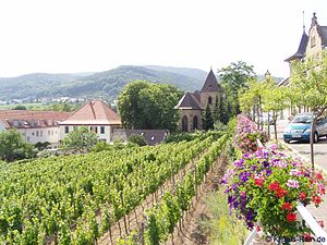
To the left of the center of the picture the Nebelberg, to the right behind the Weinbiet |
||
| height | 319 m above sea level NHN | |
| location | Palatinate Forest ( Rhineland-Palatinate , Germany ) | |
| Mountains | Haardt | |
| Coordinates | 49 ° 22 '26 " N , 8 ° 8' 36" E | |
|
|
||
| rock | Stone unit medium red sandstone | |
| Age of the rock | by 250 million years | |
| particularities | Lower Buntsandstein rock uncovered at two quarries | |
The Nebelberg , also Nöpelberg , more rarely Lindenberg , in Rhineland-Palatinate is 319 m above sea level. NHN high east runner of the Weinbiet on the eastern edge of the Palatinate Forest to the Upper Rhine Plain .
geography
The Weinbiet massif above Neustadt an der Weinstrasse lies on the western shoulder of the rift valley , which led to the subsidence of the Rhine plain about 65 million years ago. The east runner stretches for almost 2 km to the Neustadt district of Gimmeldingen . To the north is the Gimmeldinger Tal , in which the Mußbach flows, and to the south is the Eichkehle .
The Nebelberg is only accessible by hiking trails. On its eastern spur is the Heidenburg , a Franconian ring wall from the 9th century, the name of which arose because the building was wrongly attributed to the Celts in the past .
geology
As over the entire Weinbiet massif, the Karlstalschichten of the Middle Buntsandstein also extend over the Nebelberg . On the eastern edge of the Nebelberg, below the Heidenburg and at a height between 294 and 312 m , the Gimmeldingen quarry , which was abandoned in 1960, is visible from afar as a large, bright spot 180 m wide and 18 m high. It shows the exposed yellowish bleached sandstone of the Rehberg layers of the Lower Buntsandstein and was expanded in 2007/2008 by the city of Neustadt as well as nature conservation and climbing organizations to a climbing quarry with around 60 routes. On the southern edge of the Nebelberg, above the Eichkehle, the approximately 250 m wide and 40 m high Haardter quarry, which delivers the same material and whose crown is 279 m above sea level, is located. NHN Höhe is the only one still in operation on the eastern edge of the Palatinate Forest.
Surname
The name Nebelberg refers to the wafts of mist that rise above the summit after prolonged rain and cover the summit of the wine region behind. When the Palatinate was subordinated to the Kingdom of Bavaria after the end of the Napoleonic era in 1816 and was then mapped by its officials, they translated the word Näwwelberg , which was heard in the local dialect , into written German as they understood it - as Nöpelberg . The term is still common in older literature.
Individual evidence
- ↑ a b c d Neustadt local mountains: The wine region. Stadt Neustadt, accessed on April 10, 2019 (leaflet with descriptions of prominent points on the Weinbiet massif).
- ↑ Walter Eitel man: Ritterstein in the Palatinate Forest . ISBN 3-00-003544-3 .
- ↑ Albert H. Keil: Bavarian "Language Heritage" in the Palatinate. Verlag PfalzMundArt, accessed on April 10, 2019 .

