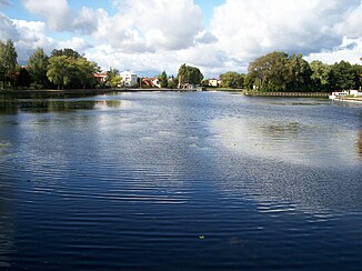
Netta (Biebrza)
| Nice | ||
|
The Netta in Augustów |
||
| Data | ||
| location | Podlaskie Voivodeship , Poland | |
| River system | Biebrza | |
| Drain over | Biebrza → Narew → Vistula → Baltic Sea | |
| source | in Lake Rospuda Filipowska 54 ° 13 ′ 24 ″ N , 22 ° 34 ′ 33 ″ E |
|
| muzzle | Biebrza coordinates: 53 ° 36 '35 " N , 22 ° 55' 55" E 53 ° 36 '35 " N , 22 ° 55' 55" E
|
|
| length | 102 km | |
| Catchment area | 1336 km² | |
| Flowing lakes | Rospuda Filipowska (spring lake) , Garbaś , Sumowo , Bolesty , Necko | |
| Medium-sized cities | Augustów | |
| Navigable | Yes | |
The Netta (German: Meten river ) is a 102 km long orographically right tributary of the Biebrza in northeastern Poland . It has a catchment area of 1,336 km². Its natural river bed has been partially canalized with the 11 km long Augustów Canal , which serves as a connecting road between the river basins of the Vistula ( Wisła in Polish ) and the Baltic - Belarusian Memel ( Nemunas in Lithuanian ).
geography
The upper course of the river is the Rospuda , which extends from the Niskie Jezioro to the Rospuda Augustowska lake . The middle course is determined by the Kanał Bystry , which extends from Lake Necko ( Eng .: Metensee ) to Lake Sajno , from which the lower course of the Netta extends into the Biebrza river.
The source river of the Netta is fed by numerous springs in and around Lake Rospuda Filipowska and flows through a dozen other lakes. From the city of Augustów it leads in a canalized state through the Augustów Canal ( Kanał Augustowski ) to the Biebrza National Park ( Biebrzański Park Narodowy ), where it flows into the Biebrza. Parallel to the Augustów Canal, countless tributaries and branching oxbow lakes of the Netta extend south of the Necko Lake. West of the Turówka to Żarnówka , Węgorówka , Strumień , Bargłówka to Brzozówka and Tajenka . And east of the Sajnica with the Sojownica to Lake Sajno, Czerwonka and Kolnica to Lake Kolno , Sosnówka and Olszanka .
By underflow of the Netta extend next to the Sosnówka- more and Augustów channel streams of the old riverbed : DANIS , Jezierwa Biala , Jezierwa Długa , Jezierwy Dulczewskiego , Jezierwy Kaczmarynowe , Jezierwy Żydowe , Osowianka , Polak , Smurgiel and the streams Kolniczanka , Pogorzałka and the Olszanka Trench.
Places on the river include Białobrzegi , the villages of Polkowo and Sosnowo in the municipality of Sztabin and the Kolonia Netta in the municipality of Augustów.
nature
The Czerwone Bagno nature reserve extends over an area of 116.3 km² in the catchment area of the upper reaches of Lake Rospuda Augustowska around the village of Woźnawieś . Numerous species of plants and animals from bygone European eras, especially moose , still find their natural habitat here - an almost prehistoric landscape , consisting of huge forests and moorland areas with a functioning natural water balance, as it did until the beginning of the 19th century was found in large parts of Eastern and Central Europe .
References
Web links
Footnotes
- ↑ Komisja Nazw Miejscowości i Obiektów Fizjograficznych: Hydronimy (PDF file; 1.47 MB)
- ↑ Izabella Krauze-Tomczyk, Jerzy Ostrowski (oprac. Red). T. 1. Cz. 1: Wody płynące, źródła, wodospady. Główny Urząd Geodezji i Kartografii. Warszawa 2006, ISBN 83-239-9607-5 (Polish)
- ↑ dostęp 15 czerwca 2010 . (Polish)
-
↑ Biebrzanski Park Narodowy - rejon Czerwonego Bagna (Pol.)
Tomasz Kłosowski: Biebrza. Kraina moczarów. 1994. ISBN 83-85496-23-8 . (Polish)
Samojlik: Szlakiem urokliwości biebrzańskiej. 1999. ISBN 83-903733-1-9 . (Polish)
Wszechnica Biebrzańska. Zeszyt 1. 2006. ISBN 83-921241-7-0 . (pole.)

