Neuhöllbrunnbach
| Neuhöllbrunnbach | ||
|
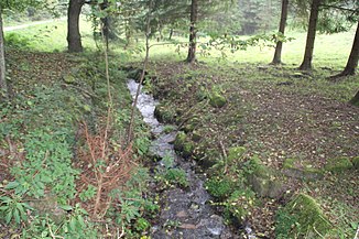
The Neuhöllbrunnbach at the entrance to Neustadt |
||
| Data | ||
| location |
Spessart
|
|
| River system | Rhine | |
| Drain over | Silberlochbach → Main → Rhine → North Sea | |
| source | on the eastern slope of the Sandstone Spessart west-northwest of Neustadt am Main 49 ° 56 '11 " N , 9 ° 31' 59" E |
|
| Source height | approx. 344 m above sea level NHN | |
| muzzle | in Neustadt in den Silberlochbach Coordinates: 49 ° 55 '50 " N , 9 ° 33' 43" E 49 ° 55 '50 " N , 9 ° 33' 43" E |
|
| Mouth height | 175 m above sea level NHN | |
| Height difference | approx. 169 m | |
| Bottom slope | approx. 68 ‰ | |
| length | approx. 2.5 km | |
| Catchment area | 4.1 km² | |
The Neuhöllbrunnbach is a two and a half kilometers long brook in Spessart in Lower Franconian district of Main-Spessart , who from the west coming from the right in the silver Lochbach flows .
course
The Neuhöllbrunnbach rises on the slopes of the monastery dome , at an altitude of about 344 m above sea level. NHN , the intermittent Neuhöllbrunnen . A little further down the stream it is fed by a second spring branch on its left.
The Neuhöllbrunnbach runs through a narrow, wooded valley in a south-easterly to easterly direction to Neustadt and finally flows out at an altitude of about 175 m above sea level. NHN in Neustadt in the Silberlochbach .
From the western entrance to Neustadt, the Neuhöllbrunnbach branches out several times. A partial arm runs through pipes under the Neustadt monastery and flows into the Main (Lage) at the pedestrian bridge to Erlach .
See also
Web links
- The Neuhöllbrunnbach on the BayernAtlas
- Brooks , Neustadt am Main - yesterday and today
