Neuhaus (Aufseß)
|
Neuhaus
community Aufseß
Coordinates: 49 ° 54 ′ 36 ″ N , 11 ° 13 ′ 33 ″ E
|
|
|---|---|
| Height : | 410 m above sea level NHN |
| Incorporation : | May 1, 1978 |
| Postal code : | 91347 |
| Area code : | 09274 |
|
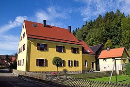
Neuhaus townscape
|
|
The parish village of Neuhaus is part of the municipality of Aufseß in Upper Franconia .
geography
Neuhaus is located three kilometers north of Aufseß and is at an altitude of 410 meters.
history
As a result of the administrative reforms carried out in the Kingdom of Bavaria at the beginning of the 19th century , the place became an independent rural community. In the course of the first phase of the municipal territorial reform carried out in Bavaria in the 1970s , the municipality of Sachsendorf was incorporated into Neuhaus in 1971 . In 1978 the enlarged community Neuhaus was incorporated into the community Aufseß.
Attractions
traffic
The state road 2189 binds Neuhaus an to the public road network, it passes through the city of Aufseß the south Coming northeast to Sachsendorf.
Web links
- Location of Neuhaus in the BayernAtlas (accessed May 31, 2017)
- Neuhaus on a historical map (BayernAtlas Klassik) (Accessed May 31, 2017)
Individual evidence
- ^ Neuhaus in the local database of the Bayerische Landesbibliothek Online
- ↑ Historical municipality register for the Federal Republic of Germany (1970–1982), page 676


