New Siberia
| New Siberia | |
|---|---|
| Map of the New Siberian Islands | |
| Waters | Arctic Ocean |
| Archipelago | Anjou Islands ( New Siberian Islands ) |
| Geographical location | 75 ° 5 ' N , 148 ° 27' E |
| surface | 6th 200 km² |
| Highest elevation | 76 m |
| Residents | uninhabited |
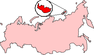
New Siberia (Russian: Новая Сибирь, Nowaja Sibir) is the second largest of the Anjou Islands , geographically it belongs to the archipelago of the New Siberian Islands and is located in the East Siberian Sea .
The island is about 6200 km² and very flat, its highest point rises only 76 m above sea level. It consists mainly of layers from the Quaternary and is thus a product of the Ice Age . Those places that are not covered by ice have tundra vegetation.
The island was discovered by Russian traders in 1806. In 1886 Eduard von Toll traveled and mapped the island.
Individual evidence
- ↑ Leopold von Schrenck , Alexander Bunge , Eduard Toll : The expedition to the New Siberian Islands and the Jana Lands equipped by the Imperial Academy of Sciences , Saint Petersburg 1887, p. 22
literature
- B. Vvedensky et al: Bolshaya sovetskaya enziklopedija: Tom 30 . Isd-wo Bolschaja sovetskaja enziklopedija, Moscow 1954, p. 62 (Russian)
- Sergei Popov: Morskije imena Jakutii . Jakutskoje knischnoje isd-wo, 1987, pp. 56-57. (Russian)
Web links
- Entry in the North encyclopedia (English)


