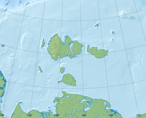
Vasilyevsky Island (Laptev Sea)
| Vasilyevsky Island | ||
|---|---|---|
| Waters | Laptev Lake | |
| Archipelago | Lyakhov Islands ( New Siberian Islands ) | |
| Geographical location | 74 ° 14 ' N , 133 ° 26' E | |
|
|
||
| length | 7.4 km (1823) | |
| width | 463 m (1823) | |
| Highest elevation | 15 m | |
| Map of the New Siberian Islands from the mid-1820s with the Semyonovsky and Vasilyevsky Islands. | ||
The Wassiljewski-Insel (also Wassiljew-Insel , Russian Остров Васильевский ) was one of the Lyachow Islands of the New Siberian Islands in the Laptev Sea . Since it was mapped by Pyotr Anjou in 1823, it quickly eroded and disappeared until 1936. Today, the Vasilyevsky Bank (Васильевская банка) is located at its location .
The Yakut Maxim Lyachow discovered Vasilyevsky Island together with Semyonovsky Island to the north of it in 1815 when he lost his direction on a sleigh ride from the Lena Delta to Kotelny . Eight years later, the Russian explorer Pyotr Anjou visited the island on a sleigh trip to Belkovsky Island . At the time, it was 7.4 kilometers long and almost half a kilometer wide. On September 12, 1881, George Washington DeLong passed the island with the other shipwrecked Jeannette after he had rested for two days on Semyonovsky Island. By 1912, when participants in the Northern Arctic Ocean Hydrographic Expedition landed on it, the length of Vasilyevsky Island had been reduced to 4.6 km. Their height was about 15 to 16 meters. In 1936 she could no longer be found. Semjonowski Island disappeared around 1950. About 40 km southwest of its previous position, a new island was discovered in 2013, which was named Jaja .
The reason for the disappearance of the Semyonovsky and Vasiliewski Islands is likely to be thermoabrasion , a form of permafrost erosion caused by thawing ice blocks inside sediments .
Individual evidence
- ^ Leopold von Schrenck : On the prehistory of the expedition equipped by the Imperial Academy of Sciences to the New Siberian Islands and the Jana Land . In: L. von Schrenck, CJ Maximowicz (ed.): Contributions to the knowledge of the Russian Empire and the neighboring countries of Asia , third volume, Volume III, St. Petersburg 1887, pp. 1–61, here p. 34 .
- ↑ Schrenck: On the prehistory of the expedition equipped by the Imperial Academy of Sciences to the New Siberian Islands and the Jana Land , 1887, p. 38 .
- ↑ a b Е.В. Клюев, А.А. Котюх, Н.В. Оленина: Картографо-гидрографическая интерпретация исчезновения в море Лаптевых остевых. Известия всесоюзного географического общества. 1981, 6th edition, pp. 485-492 (Russian).
- ^ The voyage of the Jeannette: The ship and ice journals of George W. De Long, Lieutenant-commander USN and commander of the Polar Expedition of 1879–1881 , Volume 2, The Riverside Press, Cambridge 1884, p.744 (English) .
- ↑ Директор Усть-Ленского заповедника: в России появился новый остров в море Лаптевых , TASS on April 11, 2014, accessed on August 7, 2014, in Russian.
- ↑ Natalia Pavlova: New island of Jaja on Russia's map ( Memento from August 8, 2016 in the Internet Archive ), Voice of Russia on October 10, 2014.
- ↑ Bernhard Peregovich: The postglacial sedimentation history of the Laptev Sea: heavy mineralogical and sediment petrographical investigations (PDF; 2.33 MB). Reports on polar research 316, 1999, ISSN 0176-5027 , p. 7 f.


