
Ngiwal
| Ngiwal | |
|---|---|

|
|
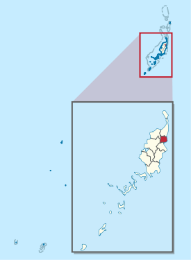
| geography | |
| Country: | Palau |
| Waters: | Pacific Ocean |
| Islands: | Babeldaob |
| Geographical location: | 7 ° 33 ' N , 134 ° 37' E |
| Basic data | |
| Surface: | 26 km² |
| Residents: | 282 |
| Population density: | 11 inhabitants / km² |
| Capital: | Ngercheluuk |
| Situation map | |
  |
|
Ngival is an administrative state (i.e., an administrative area) of the Pacific island republic of Palau . The 26 km² large sub-state, consisting of the villages (hamlets) Ngelau, the capital Ngercheluuk and Ngermechau, is located in the east of the main island Babeldaob . In 2015, 282 people lived there.