
Hatohobei
| Hatohobei | |
|---|---|

|
|
| geography | |
| Country: | Palau |
| Waters: | Pacific Ocean |
| Islands: | Atoll and an island |
| Geographical location: | 3 ° 0 ′ N , 131 ° 7 ′ E |
| Basic data | |
| Surface: | 3 km² |
| Residents: | 25th |
| Population density: | 8 inhabitants / km² |
| Capital: | Hatohobei ( Tobi ) |
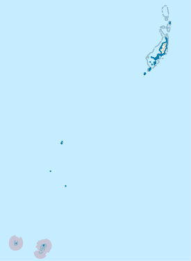
| Situation map | |
  |
|
Hatohobei or Tobi is an administrative state (i.e., an administrative area) of Palau . The administrative area, consisting of an island and an atoll , has a land area of only 3 km² and a total of 25 inhabitants (as of 2015). It is located almost 600 km southwest of the main island Babeldaob .
The main town is the village of the same name Hatohobei on the island of Tobi . The languages of the population are Sonsorolese , Palaui and English .
The areas that belong to Hatohobei form with the islands of the state of Sonsorol , which are 200 km to the north , a group that translates as “ Southwest Islands of Palau ”.
The Hatohobei state includes:
| Island name | Main village | population | Land area (in km²) | Coordinates |
|---|---|---|---|---|
| Tobi | Hatohobei | 20th | 0.60 | 3 ° 0 ' N , 131 ° 7' E |
| Helen Reef 1 | - | 0 | 0.03 | 2 ° 54 ' N , 131 ° 48' O |
| Transit Reef 2 | - | 0 | - | 2 ° 47 ' N , 132 ° 32' E |
Notes:
1 Helen Reef is an atoll with a tiny area of land ( Helen Island ) to the north.
2 The existence of the transit reef is controversial; it is not shown on all nautical charts.