Sonsorol (Palau)
| Sonsorol | |
|---|---|

|
|
| geography | |
| Country: | Palau |
| Waters: | Pacific Ocean |
| Islands: | Main island and 3 kl. Islands |
| Geographical location: | 5 ° 20 ' N , 132 ° 13' E |
| Basic data | |
| Surface: | 3 km² |
| Residents: | 44 |
| Population density: | 15 inhabitants / km² |
| Capital: | Dongosaru |
| Situation map | |
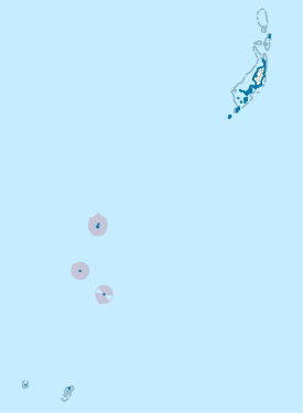
Sonsorol is an administrative state (an administrative unit ) of Palau . The area, which consists of four islands , has a land area of only 3.30 km² and a total of 44 inhabitants (as of 2015). It is located about 350 km southwest of Melekeok .
The main town is Dongosaru on the island of the same name, Dongosaru . The languages of the population are Sonsorolese , Palaui and English . The islands that belong to Sonsorol form a group with another 200 km south of the Hatohobei state , which translates as " Southwest Islands of Palau ". According to the constitution, the four islands simultaneously form the four municipalities of the island. The official names of the parishes are: Fanna, Dongosaro, Puro and Melieli. Although Fanna is supposed to exist as an official community with a "Chief Mariano W. Carlos", there are no sources of any settlement on the island.
The following islands belong to the state of Sonsorol:
From North to south:
| Island name | main place | Pop. | Land area (in km²) |
Coordinates |
|---|---|---|---|---|
| Fanna | Fanna | 0 | 0.54 | 05 ° 21 '13 " N , 132 ° 13' 38" E |
| Dongosaro | Dongosaro | 50 | 1.36 | 05 ° 19 ′ 37 ″ N , 132 ° 13 ′ 23 ″ E |
| Pulo Anna | Puro | 40 | 0.50 | 04 ° 39 ′ 18 ″ N , 131 ° 57 ′ 05 ″ E |
| Merir | Melieli | 10 | 0.90 | 04 ° 18 ′ 48 ″ N , 132 ° 18 ′ 39 ″ E |
Web links
Individual evidence
- ↑ 2015 Census of Population, Housing and Agriculture for the Republic of Palau. Office of Planning and Statistics, 2017.
- ↑ Constitution of Sonsorol State (English).
- ↑ Brief History of Sonsorol Municipality ( Memento of the original from March 4, 2016 in the Internet Archive ) Info: The archive link was inserted automatically and has not yet been checked. Please check the original and archive link according to the instructions and then remove this notice. (English).

