
Koror (Palau)
| Koror | |
|---|---|

|
|
| geography | |
| Country: | Palau |
| Waters: | Pacific Ocean |
| Islands: | Koror island and numerous small Islands |
| Geographical location: | 7 ° 22 ′ N , 134 ° 29 ′ E |
| Basic data | |
| Surface: | 65 km² |
| Residents: | 11,444 |
| Population density: | 176 inhabitants / km² |
| Capital: | Koror |
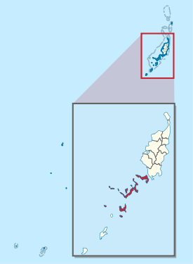
| Situation map | |
  |
|
Koror (also Eoueldaob ) is an administrative state (i.e. an administrative area) of the Pacific island republic of Palau . It is located southwest of the administrative areas of Babelthuap and northeast of the Peleliu state .
The area of the 65 km² state of Koror includes, in addition to the island of the same name, numerous islands and archipelagos , of which only a few ( Arakabesan (Ngerkebesang) and Malakal (Ngemelachel)) are inhabited. The provincial capital Koror , former capital of Palau, is located in the northwest of Koror Island, in Madalai (Medalaii).
In 2015, around 11,444 people lived in the entire administrative area, the vast majority on the island of Koror.
The state of Koror is divided into 13 so-called "hamlets" (villages): On the island of Koror (10,743 inh.) Are the places:
- Madalai (Medalaii) (2,207 pop.) Including Malakal (Ngemelachel)
- Ngerchemai (1,871 pop.)
- Ngerbeched (1,534 pop.)
- Ngermid (1,196 pop.)
- Iebukel (Iyebukel) (1,065 pop.)
- Ngerkesoaol (933 pop.)
- Idid (722 pop.)
- Meketii (505 pop.)
- Ikelau (435 pop.)
- Ngerongel (Tngeronger or Dngerongel) (275 pop.)
On the island of Arakabesan (Ngerkebesang) (1,933 inh.) Are the places:
- Meyuns (1,153 pop .)
- Ngerkebesang (427 pop.)
- Eang (Echang) (353 pop.)
According to other sources, Koror counts only 11 "hamlets". Accordingly, all villages on the island of Arakabesan belong to Meyuns.
Koror is led by hereditary chiefs. Ibedul Gibbons has headed the state since 1972 .
Web links
- Constitution of Koror State. In: Pacific Digital Library. July 15, 1997(English).
Individual evidence
- ↑ 2015 Census of Population, Housing and Agriculture for the Republic of Palau. (pdf, 30 MB) Office of Planning and Statistics, February 14, 2017, p. 10 , accessed on June 26, 2018 (English).
- ↑ 2005 Census of Population and Housing of the Republic of Palau. (pdf, 1.1 MB) Office of Planning and Statistics Republic of Palau Koror, Palau, December 2005, p. 11: Table 1: Summary of General Characteristics of Persons: 2005 , archived from the original on June 1, 2007 ; accessed on June 26, 2018 (English).
- ↑ Coror. ( bmp , 4.6 MB) (No longer available online.) In: Palaunet.com. September 13, 2007, archived from the original on March 5, 2016 ; accessed on June 26, 2018 (overview map from Koror). Info: The archive link was inserted automatically and has not yet been checked. Please check the original and archive link according to the instructions and then remove this notice.
- ↑ Ben Cahoon: Traditional chiefs of Palau. In: wordstatesmen.org. Retrieved June 26, 2018 .