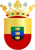
Nijefurd
 flag |
 coat of arms |
| province |
|
| local community |
|
|
Area - land - water |
289.17 km 2 96.5 km 2 192.67 km 2 |
| Residents | 10,971 (Dec. 31, 2010) |
| Coordinates | 52 ° 59 ′ N , 5 ° 26 ′ E |
| Important traffic route |
|
| prefix | 0514, 0515 |
| Postcodes | 8584, 8711-8779 |
Nijefurd ( ) is a former municipality in the province of Friesland ( Netherlands ). It had 10,971 inhabitants (as of December 31, 2010). Since January 1st, 2011 Nijefurd has been part of the newly formed municipality of Southwest Fryslân .
The administrative seat was Workum , the other places in the municipality were: Hemelum, Hindeloopen , It Heidenskip, Koudum, Molkwerum, Scharl, Stavoren and Warns.
politics
Distribution of seats in the municipal council
| Political party | Seats | |||
|---|---|---|---|---|
| 1994 | 1998 | 2002 | 2006 | |
| CDA | 7th | 6th | 6th | 5 |
| PvdA | 4th | 3 | 3 | 3 |
| FNP | - | 1 | 2 | 2 |
| VVD | 2 | 2 | 3 | 2 |
| GroenLinks | 1 | 1 | 1 | 2 |
| ChristenUnie | - | - | - | 1 |
| D66 | 1 | 1 | 0 | - |
| Algemeen Ouderen Verbond / Unie55 + | - | 1 | - | - |
| total | 15th | 15th | 15th | 15th |
Web links
Commons : Nijefurd - collection of images, videos and audio files
Individual evidence
- ↑ a b Bevolkingsontwikkeling; regio per maand Centraal Bureau voor de Statistiek , accessed on June 19, 2018 (Dutch)
- ↑ Allocation of seats in the municipal council: 1994–2002 2006 , accessed on June 19, 2018 (Dutch)
