Nimishillen Creek
| Nimishillen Creek | ||
|
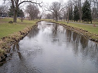
West Branch Nimishillen Creek in the city of Canton |
||
| Data | ||
| Water code | US : 1067080 | |
| location | northeastern Ohio (USA) | |
| River system | Mississippi River | |
| Drain over | Sandy Creek → Tuscarawas River → Muskingum River → Ohio River → Mississippi River → Gulf of Mexico | |
| Confluence of | East Branch and Middle Branch Nimishillen Creek in the eastern portion of the city of Canton in Stark County, OH 40 ° 48 ′ 26 ″ N , 81 ° 21 ′ 14 ″ W |
|
| Source height | 313 m | |
| muzzle |
Sandy Creek , 1 km southeast of the village of Sandyville in Tuscarawas County, OH Coordinates: 40 ° 38 ′ 0 ″ N , 81 ° 21 ′ 54 ″ W, 40 ° 38 ′ 0 ″ N , 81 ° 21 ′ 54 ″ W |
|
| Mouth height | 279 m | |
| Height difference | 34 m | |
| Bottom slope | 0.85 ‰ | |
| length | 40 km | |
| Catchment area | 487 km² | |
| Left tributaries | West Branch Nimishillen Creek, Middle Branch Nimishillen Creek | |
| Right tributaries | East Branch Nimishillen Creek | |
| Reservoirs flowed through | Beach City Lake | |
| Big cities | Canton (Ohio) | |
The Nimishillen Creek is a 40 km long right tributary of Sandy Creek in the northeastern US state of Ohio .
It drains an area of 487 square kilometers and is part of the river system of the Mississippi River . It drains into the Gulf of Mexico via the Sandy Creek, Tuscarawas River , Muskingum River , Ohio River, and Mississippi River .
The Nimishillen Creek arises from the confluence of East Branch Nimishillen Creek and Middle Branch Nimishillen Creek in the east of the city of Canton in Stark County . It flows generally south through Stark County and joins Sandy Creek 1 kilometer south of the village of Sandyville in northern Tuscarawas County . The catchment area is mainly used for agriculture in the north and northeast, while the city of Canton is in the middle with industrial settlements, which have been identified as the main cause of the existing water pollution . According to the Geographic Names Information System , Nimishillen Creek has had several names throughout its history, including Memenshehelas Creek , Nanashehelas Creek, and Nine Shilling Creek .
Web links
- Nimishillen Creek in the United States Geological Survey's Geographic Names Information System
- Nimishillen Creek Watershed
- State Action Plan
Individual evidence
- ↑ a b Google Earth altitude for GNIS coordinates, accessed on August 14, 2010.
- ↑ a b c d Nimishillen Creek Watershed ( Memento of the original from December 27, 2010 in the Internet Archive ) Info: The archive link was automatically inserted and not yet checked. Please check the original and archive link according to the instructions and then remove this notice.
- ^ East Branch Nimishillen Creek in the Geographic Names Information System of the United States Geological Survey
- ↑ Middle Branch Nimishillen Creek in the Geographic Names Information System of the United States Geological Survey
- ↑ Nimishillen Creek in the Geographic Names Information System of the United States Geological Survey
