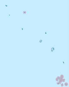
Niutao (District)
Niutao is one of the eight administrative districts ( Falekaupule ) of the Pacific island state of Tuvalu . It is made up of the island of the same name Niutao and the island of Niulakita , which was only populated in 1949 . The two islands are about 570 kilometers apart.
The district is headed by an island council ( Kaupule ) with six members. The main town is Kulia on Niutao.
| island | main place | surface | Mono- inhabitants 2 |
Islands | Villages | Coordinates | ||
|---|---|---|---|---|---|---|---|---|
| Niutao | Kulia | 2.53 km² | 606 | 1 | 2 | 6 ° 7 ′ S , 177 ° 21 ′ E | ||
| Niulakita | Niulakita | 0.42 km² | 27 | 2 | 1 | 10 ° 47 ′ S , 179 ° 28 ′ E | ||
| Kulia | 2.95 km² | 633 | 3 | 3 | ||||
| 2 2012 census | ||||||||
