
Funafuti
| Funafuti | ||
|---|---|---|
 |
||
| Waters | Pacific Ocean | |
| archipelago | Ellice Islands | |
| Geographical location | 8 ° 30 ′ S , 179 ° 7 ′ E | |
|
||
| Number of islands | at least 30 | |
| Main island | Fongafale | |
| Land area | 2.79 km² | |
| Lagoon area | 277 km² | |
| Residents | 6200 (2012) | |

Funafuti [ funaˈfuːti , engl. fuːnəˈfuːtɪ ] is a geographical atoll in the island state of Tuvalu . All state institutions are located in the village of Vaiaku on the island of Fongafale located there .
Funafuti is also the only municipality and one of eight districts (Falekaupule) of the independent state of Tuvalu.
The atoll's lagoon measures approximately 18 km × 14 km. The narrow strip of land between the lagoon and the open sea is a maximum of about 200 meters wide. The land area is 2.79 square kilometers and the total area with lagoon is 277 square kilometers.
population
The population is 6,152 (2012 census). Around 60 percent of Tuvaluans live on Funafuti. This makes it the most densely populated atoll in the country. The largest inhabited island is Fongafale in the east of the atoll with the village of Vaiaku (682 inhabitants) as the seat of government. Sometimes Fongafale or Vaiaku are given as the capital, but the entire municipality of Funafuti is the official capital.
The individual villages are:
![]() Map with all coordinates: OSM | WikiMap
Map with all coordinates: OSM | WikiMap
| Village | Island (location) | Population (2012) |
Coordinates |
|---|---|---|---|
| Alapi | Fongafale (center) | 1,059 | 8 ° 31 '15 " S , 179 ° 11' 48" E |
| Amatuku | Amatuku | 128 | 8 ° 26 ′ 16 ″ S , 179 ° 10 ′ 13 ″ E |
| Fakaifou | Fongafale (center) | 1,191 | 8 ° 31 ′ 3 ″ S , 179 ° 12 ′ 3 ″ E |
| Funafala | Funafala | 18th | 8 ° 37 ′ 42 ″ S , 179 ° 6 ′ 7 ″ E |
| Lofeagai | Fongafale (north) | 629 | 8 ° 28 ′ 52 ″ S , 179 ° 11 ′ 32 ″ E |
| Senala | Fongafale (center) | 1,222 | 8 ° 31 ′ 3 ″ S , 179 ° 11 ′ 54 ″ E |
| Tekavatoetoe | Fongafale (south) | 651 | 8 ° 32 ′ 6 ″ S , 179 ° 11 ′ 8 ″ E |
| Teone | Fongafale (north) | 572 | 8 ° 29 ′ 57 ″ S , 179 ° 11 ′ 42 ″ E |
| Vaiaku | Fongafale (center) | 682 | 8 ° 31 '28 " S , 179 ° 11' 39" E |
geography
The Atoll comprises at least 30 islands, the TeNamo - lagoon surrounded, with 275 square kilometers and up to 52 meters depth far the largest lagoon in Tuvalu, followed by the lagoon of the atoll Nukufetau with 142 square kilometers. The land area of Funafuti, on the other hand, is 2.8 square kilometers in the middle of the nine islands or atolls of Tuvalu.
To the southeast of the atoll is Nukulaelae ; To the northwest are Nukufetau and Vaitupu Island . The western part of the atoll lies in the Funafuti Conservation Area , a 33 km² marine reserve that has existed since 1996.
climate
| Funafuti | ||||||||||||||||||||||||||||||||||||||||||||||||
|---|---|---|---|---|---|---|---|---|---|---|---|---|---|---|---|---|---|---|---|---|---|---|---|---|---|---|---|---|---|---|---|---|---|---|---|---|---|---|---|---|---|---|---|---|---|---|---|---|
| Climate diagram | ||||||||||||||||||||||||||||||||||||||||||||||||
| ||||||||||||||||||||||||||||||||||||||||||||||||
|
Average monthly temperatures and rainfall for Funafuti
Source: wetterkontor.de
|
|||||||||||||||||||||||||||||||||||||||||||||||||||||||||||||||||||||||||||||||||||||||||||||||||||||||||||||||||||||||||||||||||||||||||||||||||||||||||||||||||||||
Infrastructure

On Funafuti there is only one road, about ten kilometers long, that runs through the entire length of the island of Fongafale from north to south. The atoll is home to Funafuti International Airport , which opened in 1943 and is Tuvalu's only international airport. The largest and most important building on Funafuti is the Government Palace, the seat of the Parliament of Tuvalu. On Funafuti there is also the only bank Tuvalus, a post office, two elementary schools, the building of the Tuvalu telecommunications company and a small hospital.
gallery

Oblique aerial view from the west with Vaiaku in the foreground

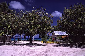
Beach on Funafuti
Funafuti School
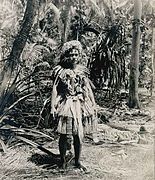
Resident, 1900

A weather station in the east of Funafuti


Web links
- 300 photos for Funafuti (English)
Individual evidence
- ^ Tuvalu Online GIS. Tuvalu Central Statistics Office, January 2015, accessed January 8, 2015 .
- ↑ Funafuti. TuvaluIslands.com, date unknown retrieved July 30, 2014
- ↑ ftp://rock.geosociety.org/pub/reposit/2001/2001075.pdf ( page no longer available , search in web archives ) Info: The link was automatically marked as defective. Please check the link according to the instructions and then remove this notice.
- ↑ Tuvalu Funafuti Conservation Area ( Memento from May 9, 2013 in the Internet Archive ) Ministry of Communication, Transport & Tourism, Government of Tuvalu (English).
- ↑ Kogatabu Funafuti Conservation Area, map of the protected area. TuvaluIslands.com. Retrieved September 28, 2015