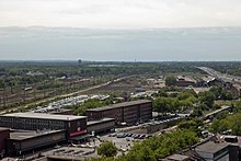
North-South Street (Duisburg)
The north-south road (also north-south axis called) is a former inner-city expressway in Duisburg and progenitor of the first urban motorway (West) Germany, today Bundesautobahn 59 .
history
In 1929 the previously independent town of Hamborn was merged with Duisburg (until 1935 Duisburg-Hamborn ), but due to the Ruhrort harbor between them there were hardly any transport connections. Long before that there had been plans to remedy this deficiency.
As early as 1928 the plan for a combined tram and tram connection between Duisburg city center and Hamborn was drawn up. Together with the new construction of Duisburg Central Station in 1934, the station forecourt was laid out on two traffic levels. At the same time, a bridge was built over the future route along Königstraße, from which a ramp for the tram to the tram stop was built on the lower level (see also the history of the Duisburg Hauptbahnhof underground station )
Due to the Second World War, the further construction was delayed and due to a change in transport policy in the 1950s in favor of private transport, the original plan was abandoned in favor of a purely urban expressway, from 1952 the north-south road was part of Duisburg's economic plan.
Initially, construction was carried out towards the south. The first section between Landfermannstrasse and Koloniestrasse was started on April 24, 1955 and inaugurated on May 27, 1957. The next section to Grunewald followed on July 13, 1959. Although it is still quite short, this is the first urban motorway in (West) Germany.
The construction to the north turned out to be incomparably more difficult not only because of the port facilities to be bridged, the route through an area with mountain damage also made progress more difficult. The ramp from Landfermannstrasse via the eastern inner harbor , the Duisburg port railway and the then Federal Motorway 2 (today Federal Motorway 40 ) to the Ruhr dike was only completed on June 19, 1962.
This is followed by Europe's longest road bridge (1,824 m), which had to bridge the Ruhr , the Rhine-Herne Canal and the basins of the Ruhrort port . In view of this enormous distance, it was given the name Berliner Brücke as a sign of solidarity with the inhabitants of Berlin , which is expressed by two sculptures at the southern end of the bridge. These each show a stylized group of people who - separated by the newly built street - wave to each other.
Willy Brandt , the governing mayor of West Berlin , is present both at the laying of the foundation stone on June 8, 1960 and at the opening of the bridge on September 6, 1963. In the meantime, the Berlin Wall is being built in Berlin .
From the Berliner Brücke in Meiderich, the north-south road runs high up through a densely populated area. This section of the route to Warbruckstrasse in Marxloh, which was completed on October 7, 1969, is still noticeable today due to its narrow and winding route.
An elaborate bridge has to be built to the south, as the busy crossing at Grunewald is crossed on the first level by the Cologne – Duisburg railway and on the second level by the Mönchengladbach – Duisburg railway and the Osterath – Dortmund Süd railway. The section up to Wacholderstraße in Wanheimerort including the 1,016 m long Grunewald Bridge was opened on October 29, 1975. On April 1, 1977, the last section built under the direction of the city of Duisburg followed up to Sittardsberger Allee in Buchholz.
Federal motorway 59
The northern part of the north-south road from the (motorway) junction Duisburg am Ruhrdeich to the northern end of the expansion was elevated to federal highway 59 on January 1, 1979, two years later on January 1, 1981, the rest followed up to the end of the southern expansion.
In the meantime, the federal highway 59 has been continued in the north to Dinslaken and in the south to federal highway 288 on the city limits of Düsseldorf , the gap to federal highway 8 at Düsseldorf airport was completed in 2012.
With the transition to the ownership and sponsorship of the Rhineland Regional Association , the official designation as "North-South Street" ended, but this and the "North-South axis" are still used in the everyday language of the Duisburg population.
