
Notter (Unstrut)
| Notter | ||
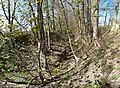
 The notter in grains. |
||
| Data | ||
| Water code | DE : 56414 | |
| location | Thuringia , Germany | |
| River system | Elbe | |
| Drain over | Unstrut → Saale → Elbe → North Sea | |
| source | Forest area west of the Pöthen shaft 51 ° 17 ′ 33 ″ N , 10 ° 34 ′ 4 ″ E |
|
| Source height | approx. 380 m above sea level NN | |
| muzzle | In Bollstedt in the Unstrut coordinates: 51 ° 12 '5 " N , 10 ° 31' 19" E 51 ° 12 '5 " N , 10 ° 31' 19" E |
|
| Mouth height | 187.3 m above sea level NN | |
| Height difference | approx. 192.7 m | |
| Bottom slope | approx. 8.8 ‰ | |
| length | 21.9 km | |
| Catchment area | 121.6 km² | |
| Left tributaries | Bachgraben, Marolteröder Bach, Mehrstedter Wasser | |
| Right tributaries | Holzgraben, Wiesentalsgraben, Schmalbachsgraben | |
| Small towns | Schlotheim | |
| Communities | Mühlhausen / Thuringia , grains , Obermehler | |
The Notter is an approximately 20 km long, left-hand side stream of the Unstrut . It rises in about 380 m above sea level. NN on the Muschelkalk plateau in the Herzwinkel near Pöthen and at periodically occurring springs in lowlands in the southeast of the Mühlhäuser Hardt .
course
It initially runs as a ditch in the Hercynian direction from north-north-west to south-south-east and only carries water continuously from around Obermehler . In Schlotheim it changes to the south-south-west and flows in the Nottertal through the Keuper rocks covered with loess on the north-western edge of the Thuringian basin . West of Bollstedt it finally flows out at 190 m above sea level. NN as a straightened brook on the left into the Unstrut.
Economic history
The villages of Menteroda-Pöthen , Obermehler , Großmehlra , Schlotheim , Österkörner , Körner , Grabe and Bollstedt run through or touch between the source area and the mouth . It used to drive the Nottermühle near Großmehlra, the Loch and Bergmühle east of Körner, the oil mill west of Körner and the Furthmühle on the western edge of Grabe. The mill systems have been preserved to this day, but are now used differently, for example the Furthmühle as a hotel-restaurant.
landscape
The valley of the Notter is one of the fertile agricultural landscapes of the central Thuringian hill country that has been populated for a long time. With the exception of small alluvial forest galleries along the stream, which are dominated by the non-native poplar, there is no forest in the Nottertal. Only the surrounding limestone plateaus, in which the notter is gently embedded, are forested. The large forest areas Mühlhäuser Forst, Mühlhäuser Hardt, Volkenroder Wald as well as Small and Large Sonder are located in the catchment area of the Notter. The catchment area itself covers an area of around 120 km². The Nottertal has around 8,000 inhabitants.
Picture gallery

The Notter in Schlotheim

The Mehrstedter water (coming from the top right) flows into the Notter
The Semmengraben north of Obermehler


Tributaries
The Notter takes in the following streams between the source and the mouth:
- Schmalbach between the Pöthen settlement and Obermehler (on the right)
- Semmengraben north of Obermehler (left side)
- Schmirl between Großmehlra and Schlotheim (on the right)
- Marolteröder Bach - combined with the Mehrstedter water (coming from the Schlotheim reservoir) in Schlotheim (left)
- Quarry trench on the eastern edge of Körner (left)
- Wood trench in grains (right side)
- Bach ditch between grains and grave (left side)
- Mäusebach west of Grabe (on the right)
On some days, water is also supplied to the Notter from the Schaftal valley, a long dry valley on the southern edge of the Volkenroda forest. On the western edge of Schlotheim, it flows through a ditch on the right into the Notter.
Web links
Individual evidence
- ↑ a b Topographic map 1: 25,000
- ^ River lengths in Thuringia - State Institute for Environment and Geology.
- ^ Thuringian State Institute for the Environment (ed.): Area and waterway key figures (directory and map). Jena 1998. 26 pp.