
Nyschnja Bilka
| Nyschnja Bilka | |||
| Нижня Білка | |||

|
|
||
| Basic data | |||
|---|---|---|---|
| Oblast : | Lviv Oblast | ||
| Rajon : | Pustomyty Raion | ||
| Height : | 224 m | ||
| Area : | 2.1 km² | ||
| Residents : | 503 (2001) | ||
| Population density : | 240 inhabitants per km² | ||
| Postcodes : | 81142 | ||
| Area code : | +380 3230 | ||
| Geographic location : | 49 ° 51 ' N , 24 ° 17' E | ||
| KOATUU : | 4623680802 | ||
| Administrative structure : | 1 village | ||
| Address: | 8114 с. Верхня Білка | ||
| Statistical information | |||
|
|||


Nyschnja Bilka ( Ukrainian Нижня Білка ; Russian Нижняя Белка Nizhnyaja Belka , Polish Biłka Królewska ) is a village in the western Ukrainian Lviv Oblast with about 2040 inhabitants.
With the villages of Verkhnya Bilka and Sukhoritschtschja ( Сухоріччя ) it belongs to the district council of Verkhnya Bilka.
history
The place was mentioned in a document in 1475 as Byelka , and later as Biełka (1578), Biłka Krolewska (1769). The name is derived from the Ukrainian word for the color white; the adjective królewska (see crown property ) was used to distinguish it from the neighboring Verkhnya Bilka , in Polish Biłka Szlachecka ( noble ).
The village initially belonged to the aristocratic republic of Poland-Lithuania , Ruthenian Voivodeship , Lviv country . During the first partition of Poland in 1772 the village became part of the new Kingdom of Galicia and Lodomeria of the Habsburg Empire (from 1804). The local Vorwerk belonged to the Komorowski family since the middle of the 19th century, later to the Sapieha .
In 1900 the municipality of Biłka Królewska had 111 houses with 731 inhabitants, of which 722 Polish-speaking, 9 Ruthenian-speaking, 634 Roman Catholic, 88 Greek Catholic, 9 Jews.
After the end of the Polish-Ukrainian War in 1919, the community became part of Poland. In 1921 it had 153 houses with 920 inhabitants, 919 of them Poles, 1 Jew (nationality), 870 Roman Catholic, 29 Greek Catholic, 21 Jews (religion).
During the Second World War it belonged first to the Soviet Union and from 1941 to the General Government, from 1945 back to the Soviet Union, now part of the Ukraine . The Poles were resettled to Poland in 1945 (in the vicinity of Krosno and St. Annaberg ). In their place came Ukrainians from the Lubaczów area .
Attractions
- Former Roman Catholic Church, built in 1912.
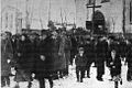
Roman Catholic Church in 1934

Web links
- Biłka 3.) królewska . In: Filip Sulimierski, Władysław Walewski (eds.): Słownik geograficzny Królestwa Polskiego i innych krajów słowiańskich . tape 1 : Aa-Dereneczna . Sulimierskiego and Walewskiego, Warsaw 1880, p. 229 (Polish, edu.pl ).
Individual evidence
- ^ Anna Czapla: Nazwy miejscowości historycznej ziemi lwowskiej [The names of the localities of the historical Lviv country] . Towarzystwo Naukowe Katolickiego Uniwersytetu Lubelskiego Jana Pawła II, Lublin 2011, ISBN 978-83-7306-542-0 , p. 10, 37 (Polish).
- ↑ Grzegorz Rąkowski: Przewodnik po Ukrainie Zachodniej. Część III. Ziemia Lwowska . Oficyna Wydawnicza "Rewasz", Pruszków 2007, ISBN 978-83-8918866-3 , p. 239 (Polish).
- ↑ Ludwig Patryn (Ed.): Community encyclopedia of the kingdoms and countries represented in the Reichsrat, edited on the basis of the results of the census of December 31, 1900, XII. Galicia . Vienna 1907.
- ↑ Główny Urząd Statystyczny: Skorowidz miejscowości Rzeczypospolitej Polskiej. Tom XIII. Województwo lwowskie . Warszawa 1924 (Polish, online [PDF]).