Wołowa Góra
| Wołowa Góra
German Ochsenberg
|
||
|---|---|---|
|
View from the tobacco dough |
||
| height | 1033 m npm | |
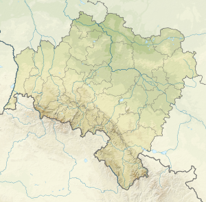
| location | Poland , Lower Silesian Voivodeship | |
| Mountains | Giant Mountains | |
| Coordinates | 50 ° 46 '3 " N , 15 ° 48' 59" E | |
|
|
||
| rock | Gneiss , mica slate | |
The Wołowa Góra (German Ochsenberg ) is one of the few mountains over a thousand meters on the Polish side of the Giant Mountains .
location
The Ochsenberg is a secondary peak of the Kammsteig and is upstream of it about 1.4 km to the north. It is located about 4 km east of Karpacz (German Krummhübel ) and almost 3 km south-southwest of Kowary (German Schmiedeberg ). It is one of the most distinctive peaks in the eastern part of the Giant Mountains and is easily recognizable from afar, as it protrudes across the Schmiedeberger ridge into the Hirschberg valley .
The impression of its height is reinforced by the fact that it seems to have grown out of the valley floor, so seamlessly it rises with a height difference of 600 meters above Kowary and its suburb Krzaczyną (German Buschvorwerk ).
Nearby peaks
| Łysa Góra | Kowarska Czuba | |
| Izbica |

|
Rudnik |
| Skalny Stół | Czoło | Sulica |
Hydrology
On the eastern slope between Kammsteig and Ochsenberg, a stream with the Polish name Piszczak (German Jockelwasser ) rises at an altitude of about 960 meters . Below the source is the Small Hole (Polish: Mała Jama ), a leveling niche that was probably formed during the last Ice Age . The water from the north-east slope also finds its way here via the Pluszcz stream (German Freiwasser or Höllenbach ) and flows into the Piszczak .
At the end of the niche on the valley side, about 540 meters above sea level, the Piszczaka Gorge (Polish : Uroczysko wąwóz Piszczaka ) begins , in which the water shoots down between the rock faces over a few small cascades to make its way to the Jedlica (German Iselbach or Eglitz ) to take. The forest area, which stretches from here down to the valley, was established as a nature reserve by the local porcelain manufacturers Gebrüder Pohl in 1900 and made accessible to the public under the name “Pohlsche Schweiz”.
The western slope drains into the Malina (German forest long water or Hofgrund ), which is also a tributary of the Jedlica . All named waters belong to the river system Oder - Baltic Sea .
history
Mining in Schmiedeberg and on Ochsenberg has a long tradition and the mining of iron ore can be traced back to the year 1355. In 1513 the town received the Bergregal , in 1564 the ore was mined on behalf of the Polish King Sigismund August , but the beginning of the Thirty Years' War led to the collapse of mining and iron smelting. The nearby clearing of forestry buildings below the Tafelstein at a high altitude is a testament to the chaos of war.
The two world wars brought about a renewed revival of mining in the 20th century, which initially resumed the mining of iron ore. From the 1920s the mining of uranium ore became increasingly important and had a major influence on the development of the city while Poland was part of the Eastern Bloc . At the foot of the eastern slope are the tunnels of important uranium mines:
- The Podgórze mine with two shafts almost 600 meters deep was in operation from 1952 to 1958. Then a radon inhalatorium was set up here to use medical radon balneology to use the healing power of the radioactive element to treat z. B. of circulatory and respiratory diseases to use.
- Wolność (formerly Grube Bergfreiheit ) - 7,000 Polish miners were employed in the mine with the code name R1 during the arms race in the Cold War .
- Sztolnie Kowary - this mine supplied the uranium for the first Soviet atomic bombs from 1948 . Today it is designed as a show mine and provides an insight into the everyday work of a mine worker. There are also various exhibits related to uranium mining. Another attraction is the Walloon Treasure, a collection of precious stones, minerals and ores from the "Sudeten Walloon Brotherhood" (Polish: Sudeckie Bractwo Walońskie ).
Tourism and nature protection
▬ Below the summit, a hiking trail with yellow markings leads to the forest buildings on the western slope.
▬ The Tabaksteig can be taken from the forest buildings, following a green marking, to the border buildings on the border pass.
The Ochsenberg lies outside the " Karkonoski Park Narodowy " and although there is a dense network of forest and hiking trails on the slopes, many of which have been designated as cross-country ski trails in recent years, this area is one of the most remote corners of the Polish Giant Mountains important refuge for the forest animals.
The summit of the mountain is barely forested and because of the good thermals that develop here, it is a preferred starting point for paragliders and can be comfortably reached on foot from the border pass ( Przelêcz Okraj in Polish ) in 30 minutes via the Tabaksteig .
Individual evidence
- ^ History of the porcelain factory Gebr. Pohl in Schmiedeberg ( Memento from March 4, 2016 in the Internet Archive )
- ↑ a b Szlaki Kulturowe - Kowary
- ↑ Przemysław Wiater: Walońscy poszukiwacze minerałów i kamieni szlachetnych w Karkonoszach i Górach Izerskich . on www.e-szklarska.com (Polish)
- ↑ Article in the monthly "SUDETY" magazine
- ↑ Page of the "Karkonosze Paragliding Club"

