Paffelsberg
| Paffelsberg | ||
|---|---|---|
| height | 195.3 m above sea level NHN | |
| location | Bonn - Oberkassel | |
| Mountains | Pleiser hill country | |
| Coordinates | 50 ° 42 '54 " N , 7 ° 11' 29" E | |
|
|
||
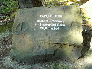
The Paffelsberg is a mountain of the Ennert roofing over the Siebengebirge to the north . It is east of the right bank of the Rhine in Bonn district in Oberkassel close to the city limits of Koenigswinter . With a height of 195.3 m above sea level. NHN (formerly: 194.8 m above sea level ) the Paffelsberg is the highest point in Bonn.
Adjacent to the west are the Rabenlay and Kuckstein elevations , to the southeast the Juffernberg and to the south the Dollendorfer Hardt, which dominates the northern part of the Siebengebirge . Like the surrounding heights, the Paffelsberg is forested and protected. It is only a gently pronounced height and merges into open land to the north and east, the corridor "Auf den Dreizehn Morgen" in the north and the village of Vinxel, which belongs to Königswinter, in the east.
annotation
- ↑ a b Information according to the digital terrain model and digital topographic map 1: 25,000 (available from the TIM-online map service )
- ↑ according to the measuring point in the German basic map 1: 5,000 and inscription stone on site
- ^ The city area , statistical office of the Federal City of Bonn

