Palais (Thouet)
| Palace | ||
|
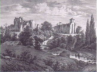
The town of Hérisson in an old view, in the foreground the upper reaches of the river. |
||
| Data | ||
| Water code | FR : L8116400 | |
| location | France , Nouvelle-Aquitaine region | |
| River system | Loire | |
| Drain over | Thouet → Loire → Atlantic Ocean | |
| source | in the municipality of Clessé 46 ° 41 ′ 59 ″ N , 0 ° 23 ′ 10 ″ W |
|
| Source height | approx. 226 m | |
| muzzle | on the municipal boundary of Parthenay and Le Tallud in the Thouet coordinates: 46 ° 38 ′ 47 " N , 0 ° 15 ′ 33" W 46 ° 38 ′ 47 " N , 0 ° 15 ′ 33" W |
|
| Mouth height | approx. 132 m | |
| Height difference | approx. 94 m | |
| Bottom slope | approx. 3.9 ‰ | |
| length | 24 km | |
The Palais is a river in France that runs in the Deux-Sèvres department in the Nouvelle-Aquitaine region . It rises under the name Ruisseau des Arcis in the municipality of Clessé , initially drains in a south-westerly direction, but then turns to the east and after 24 kilometers flows into the Thouet as a left tributary at the municipal boundary of Parthenay and Le Tallud .
Places on the river
- Hérisson , municipality of Pougne-Hérisson
- Saint-Aubin-le-Cloud
- Parthenay
Attractions
- The small town of Hérisson , on the upper reaches of the river, has three medieval buildings that are registered as Monument historique : the castle, the hostel and the church of Saint-Georges .
Remarks
- ↑ Source geoportail.fr (1: 32,000)
- ↑ estuary geoportail.fr (1: 16,000)
- ↑ a b The information on the length of the river is based on the information about the palace at SANDRE (French), accessed on May 15, 2012, rounded to full kilometers.
