Palisades dam
| Palisades dam | ||
|---|---|---|
| location | ||
|
|
||
| Coordinates | 43 ° 19 '57 " N , 111 ° 12' 18" W | |
| country |
|
|
| place | Bonneville County , Idaho | |
| Waters | Snake River | |
| Height upstream | 1713 m | |
| power plant | ||
| owner | United States Bureau of Reclamation (USBR) | |
| operator | USBR | |
| Start of planning | 1945 | |
| construction time | 1951 to 1957 | |
| Start of operation | 1957 | |
| technology | ||
| Bottleneck performance | 176.6 megawatts | |
| Average height of fall |
58 m | |
| Expansion flow | 906 m³ / s | |
| Standard work capacity | 517.4 million kWh / year | |
| Turbines | Francis turbines : 4 × 44.15 MW | |
| Others | ||
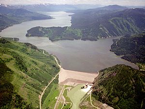
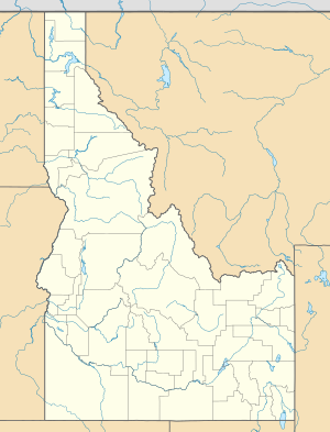
The dam Palisades ( English Palisades Dam ) is a dam with hydroelectric plant in Bonneville County , State of Idaho , USA . It dams the Snake River to a reservoir ( English Palisades Reservoir ). The dam is located approximately 17.7 km (11 miles ) west of the border between the states of Idaho and Wyoming . Approximately 10 km downstream is the small town of Irwin .
In addition to generating electricity, the dam is also used for irrigation and flood protection . It is owned and operated by the United States Bureau of Reclamation (USBR) and is also operated by the USBR.
history
Preparations for the construction of the dam began in 1945. However, the start of construction was delayed because a balance had to be found between the different interests of those affected. Construction of the dam began in 1951. It was completed in 1957. In May 1958, all the machines in the power plant were in operation.
Barrier structure
The barrier structure is an earth embankment dam with a height of 82 m (270 ft ) above the foundation level . The dam crest is 1716 m (5630 ft) above sea level . The length of the dam crest is 640 m (2100 ft). The volume of the structure is 10.37 million m³ (13.571 million cubic yards ).
The flood relief is a tunnel with a diameter of 8.5 m (28 ft). The entrance is on the right bank, about 200 m from the dam crest. A maximum of 934 m³ / s (33,000 cft / s) can be discharged via the turbine inlet, and a maximum of 1373 m³ / s (48,500 cft / s) via the flood discharge.
Reservoir
At the normal storage target of 1713 m (5620 ft), the reservoir extends over an area of around 64.75 km² (16,000 acres ) and holds 1.7 billion m³ (1.4 million acre-feet ) of water.
power plant
The power plant is located at the foot of the dam on the left side of the river. Its installed capacity is 176.6 MW . The installed capacity was originally 118.75 MW. In 1994 a performance upgrade was carried out; the generator windings were replaced. The average annual production is around 517.4 million kWh . The 4 Francis turbines of the power plant each have a maximum output of 44.15 MW. The drop height is 58 m (190 ft). The maximum flow rate is 226.5 m³ / s (8000 cft / s) per turbine.
See also
Web links
Individual evidence
- ↑ Palisades Reservoir. In: Geographic Names Information System. Retrieved December 28, 2018 (American English).
- ↑ a b c d e f Palisades Project. United States Bureau of Reclamation (USBR), accessed November 3, 2018 .
- ↑ a b c d Palisades Dam. USBR, accessed October 3, 2018 .
- ↑ Palisades Powerplant. USBR, accessed October 3, 2018 .

