
Furs
| Furs | ||
 The furs |
||
| Data | ||
| location | Dessau-Roßlau , Saxony-Anhalt | |
| River system | Elbe | |
| Drain over | Mulde → Elbe → North Sea | |
| origin | as a ditch from the Leiner See 51 ° 51 ′ 40 ″ N , 12 ° 17 ′ 7 ″ E |
|
| muzzle | in the hollow near its confluence with the Elbe Coordinates: 51 ° 52 '18 " N , 12 ° 15' 3" E 51 ° 52 '18 " N , 12 ° 15' 3" E
|
|
| length | 1.5 km | |
The fur is a flow (part of a previous side arm ) of the trough in Biosphärenreservat Mittelelbe and reserve lower tray , and in Dessau-Wörlitz near the mouth of the river in the same between Dessau and Roßlau .
The water has a length of about 1.5 km and is connected to the Leiner See and the Löbben by the river ditch. The lakes are the tributary from the Kapengraben into the Mulde. When the Mulde and Elbe floods, the fur also comes into contact with the Igel-Lache, another oxbow lake.
With 21 proven species, such as asp , zope , bitterling , wolffish , crucian carp , bleak and aland , the fur is considered to be the most species-rich backwater in the nature reserve. As early as 1927, as one of the first protected areas for a mammal in Germany, the fur was designated as a beaver protection area for the Elbe beaver .
In the corner formed by the furs at their confluence with the hollow were the Waldeser castle and a village of the same name in the 12th century .

Bridge over the river ditch, the inflow into the furs

the bridge built in 2016
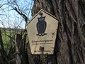
Information sign beaver reserve on the shore

Muzzle into the hollow


Individual evidence
- ↑ Information on the Untere Mulde nature reserve ( Memento of the original dated December 21, 2013 in the Internet Archive ) Info: The archive link was automatically inserted and not yet checked. Please check the original and archive link according to the instructions and then remove this notice.
- ↑ Prof. Dr. Gustav Hinze - a life for the Elbe beavers. For the beaver researcher's 125th birthday.
- ^ Heinrich Lindner: History and description of the state of Anhalt . Ackermann, 1833 ( limited preview in Google book search).