Pichanaqui
| Pichanaqui | ||
|---|---|---|
|
|
||
| Coordinates | 10 ° 56 ′ S , 74 ° 52 ′ W | |
| Basic data | ||
| Country | Peru | |
| Junín | ||
| province | Chanchamayo | |
| ISO 3166-2 | PE-JUN | |
| District | Pichanaqui | |
| height | 510 m | |
| Residents | 20,689 (2017) | |
| Website | munipichanaqui.gob.pe (Spanish) | |
| politics | ||
| mayor | Raúl Aliaga Sotomayor | |
Pichanaqui (also Bajo Pichanaqui ; alternative spelling: Pichanaki ) is a city in the province of Chanchamayo in the Junín region in central Peru . It is the administrative seat of the district of the same name . The city had a population of 20,689 at the 2017 census. Together with the neighboring suburb of Santa Rosa in the Perené district , Pichanaqui forms a metropolitan area with over 41,000 inhabitants (as of 2017).
Location
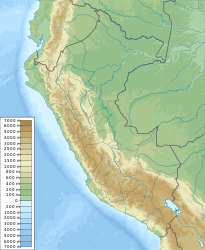
The city is located in the eastern foothills of the Peruvian Central Cordillera . It is located at an altitude of 510 m on the right bank of the Río Perené . The Río Pichanaqui flows into the Río Perené at Pichanaqui. The road from La Merced to Satipo runs through Pichanaqui .
Individual evidence
- ↑ a b PERU: Junín Region - Provinces & Places . www.citypopulation.de. Retrieved December 28, 2019.
Web links
Commons : Pichanaqui - collection of images, videos and audio files

