Satipo
| Satipo | ||
|---|---|---|
|
|
||
| Coordinates | 11 ° 15 ′ S , 74 ° 38 ′ W | |
| Basic data | ||
| Country | Peru | |
| Junín | ||
| province | Satipo | |
| ISO 3166-2 | PE-JUN | |
| District | Satipo | |
| height | 628 m | |
| Residents | 23,203 (2017) | |
| Website | www.munisatipo.gob.pe/portal/ (Spanish) | |
| politics | ||
| mayor | Ivan Olivera (2019-2022) |
|
Satipo is a city in the Junín region of central Peru . It is the capital of the Satipo Province and is located in the district of the same name . The population was 23,203 at the 2017 census. 10 years earlier it was 21,894.
geography
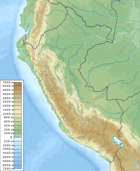
The city is located in the northeastern foothills of the Peruvian Central Cordillera on the left bank of the Río Satipo at an altitude of 628 m . From the city roads lead to Pichanaqui (to the northwest), to Mazamari (to the southeast) and to the southwest through the mountains to the cities of Huancayo and Jauja in the Andean highlands .
history
Satipo developed from a settlement that August Hilser, an immigrant from Schramberg , founded in 1898. He was followed by numerous German families who left their homeland after the end of the First World War and emigrated to Peru.
Individual evidence
- ↑ a b PERU: Junín Region: Provinces & Places . www.citypopulation.de. Retrieved January 11, 2020.

