Pipiriki
| Pipirik | ||
| Geographical location | ||
|
|
||
| Coordinates | 39 ° 29 ′ S , 175 ° 3 ′ E | |
| Region ISO | NZ-MWT | |
| Country |
|
|
| region | Manawatu-Wanganui | |
| District | Ruapehu District | |
| Ward | Waimarino-Waiouru Ward | |
| Residents | few | |
| height | 87 m | |
| Post Code | 4576 | |
| Telephone code | +64 (0) 6 | |
| Photography of the place | ||
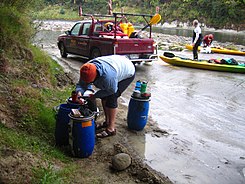
 Disembarkation in Pipiriki on the Whanganui River |
||
Pipiriki is a small settlement in the Ruapehu District of the Manawatu-Wanganui region on the North Island of New Zealand .
Origin of name
The name of the settlement is made up of the Māori terms “ pipi ” for a crustacean or a shell and “ riki ” for “something” or “some”. According to tradition, a chief in the region who was once dying is said to have asked for “ pee ” as a last wish .
geography
The settlement is located around 50 km north of Wanganui and around 21 km southwest of Raetihi in the valley of the Whanganui River . The closest two settlements to the south of the river are Jerusalem , 8.5 km southeast and Ranana , around 12.5 km in the same direction.
history
A first mission station was built in 1848 on the opposite bank. In the 1850s, Pipiriki was a center of the Pai Mārire movement, a religious sect of the Māori also known as Hauhau . They built a fortification in the settlement. After the movement suffered a military defeat on Moutoa Island on May 14, 1864 , the settlement passed to the British, who established an outpost here. In June of the following year the movement besieged the settlement, but British troops, dispatched from Wanganui , drove the besiegers away after learning of the siege situation through a message in a bottle from the commander.
tourism
Between the late 19th century and the 1950s, the settlement was a popular excursion destination with a landing stage and a guest house, which burned down in 1959. Boat trips were organized from Whanganui and Taumarunui .
Today, jeep and canoe trips are offered on the river from Pipiriki . The settlement is also the starting point for excursions to Whanganui National Park and the Bridge to Nowhere , a bridge that was once supposed to provide access to remote farm settlements, but which were later abandoned. So today the bridge "leads nowhere" and is only used by hikers.
Attractions
The settlement has a small museum about the history of the Whanganui River .
literature
- Helga Neubauer: Pipiriki . In: The New Zealand Book . 1st edition. NZ Visitor Publications , Nelson 2003, ISBN 1-877339-00-8 , pp. 495 f .
