Piz Signina
| Piz Signina | ||
|---|---|---|
|
Piz Riein, Piz Fess, Piz Signina |
||
| height | 2848 m above sea level M. | |
| location |
Switzerland , ( Graubünden ) |
|
| Mountains | Graubünden Alps | |
| Coordinates | 741069 / 176 457 | |
|
|
||
| Type | Mountains | |
| rock | slate and brittle | |
|
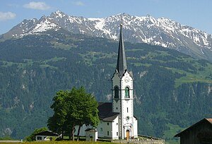
Signina group behind Ladir Church; Piz Riein on the left, Piz Fess over the steeple and Piz Signina and Günerhorn on the right |
||
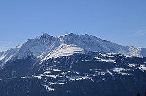
The Piz Signina is the eponymous summit of the Signina group in the Adula Alps in Switzerland . The highest peak in the group is Piz Fess ( 2874 m ). On Piz Signina, rugged rock faces fall into the Safien Valley in the east and steep scree slopes and gorges towards Riein in the Val Lumnezia in the west .
The name is derived from the former Walser settlement Signina , which is located at the west foot of the Piz Signinas in Val Lumnezia.
Access
The Piz Signina is climbed from Safien Platz / Zalöner Hütta via the Güner Lückli ( 2470 m ) and the Günerhorn (T5 SAC hiking scale ).
Signina group
The peaks of the Signinagruppe (Rhaeto-Romanic: Cadeina dil Signina ) are from north to south: Schlüechtli ( 2283 m ). Nolla ( 2384 m ), Tällistock ( 2604 m ), Piz Riein ( 2752 m ), Unterhorn ( 2556 m ), Oberhorn ( 2796 m ), Piz Fess ( 2874 m ), Piz Signina and Günerhorn ( 2851 m ). The Signinagruppe towers over the Ruinalta (Vorderrhein Gorge ) and forms the southern part of the panorama of the ski resorts of Flims and Laax.
Your horizon backdrop formed important southern bearing points for the astronomical stone rows of the Parc la Mutta near Falera, created in the Middle Bronze Age .
literature
- Barbara Steinmann, Elisabeth Bardill, Maria Hunger-Fry: Safiental - Ruinaulta, Vom Safierberg zur Rheinschlucht, Verlag Terra Grischuna, Chur 2008, ISBN 978-3-7298-1152-2 .
Web links
- Piz Signina on the ETHorama platform
- Alpine panorama: Signina group
Individual evidence
- ↑ Parc la Mutta: With its azimuth of 157 ° and its angle of inclination of 16 °, the moon arrow points to that point in the sky above Piz Fess, where on December 25, 1089 BC at 10.17 a.m., a solar eclipse of around 96 percent took place ( memento of the original from August 12, 2014 in the Internet Archive ) Info: The archive link was inserted automatically and has not yet been checked. Please check the original and archive link according to the instructions and then remove this notice.


