Plattlinger Mühlbach
|
Plattlinger Mühlbach Left Plattlinger Mühlbach |
||
|
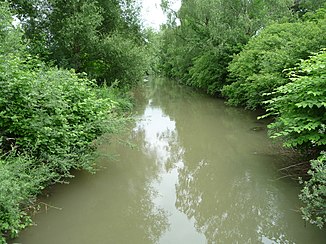
The Plattlinger Mühlbach near the Plattlinger outdoor pool |
||
| Data | ||
| location | Aholming , Plattling | |
| River system | Isar | |
| Drain over | Isar → Danube → Black Sea | |
| Source height | 319 m above sea level NHN | |
| muzzle | near Plattling in the Isar Coordinates: 48 ° 47 ′ 9 ″ N , 12 ° 54 ′ 44 ″ E 48 ° 47 ′ 9 ″ N , 12 ° 54 ′ 44 ″ E |
|
| Mouth height | 316 m above sea level NHN | |
| Height difference | 3 m | |
| Bottom slope | 0.45 ‰ | |
| length | 6.7 km | |
| Left tributaries | Reissinger Bach | |
| Small towns | Plattling | |
The Plattlinger Mühlbach , also Linker Plattlinger Mühlbach, is an approximately 5.6 kilometers long mill canal on the left side of the Isar in Lower Bavaria .
According to the "Directory of Bach and River Areas in Bavaria", the Plattlinger Mühlbach begins at the confluence of the Längenmühlbach and Laillinger Bach and is 6.68 kilometers long. At river kilometer 10.425 the Isar is diverted into the Plattlinger Mühlbach. The first 500 meters of the course are on the commune Aholming , followed by the districts Pielweichs , Plattling and Pankofen the town of Plattling to the mouth shortly before Schiltorn in a Isararm . The Plattlinger Mühlbach is a body of water III. Order.
history
At the Plattlinger Mühlbach is the Pankofener Mühle ( Lage ), which was in operation from 1837 to 2007. The height of fall at the mill was around two meters. At this point the name Reisingermühle is noted on the original position sheet:
Before the Piel Weichs hydropower plant was built, the canal was connected to the Isar and the passage under the dyke at around river kilometers 10.75. Later, both were relocated around 300 meters downstream into the underwater of the newly built barrage. For this purpose, a new branch canal with a sluice to the Isar was created near the church of St. Stephan in Piel Weichs .
From 1905 there was a bathing establishment at the Mühlbach in Plattling, where the Plattling outdoor pool was opened in 1967.
Individual evidence
- ↑ BayernAtlas: Topographic map, source
- ^ BayernAtlas: topographic map, estuary
- ↑ a b Directory of creek and river areas in Bavaria - Isar river area of the Bavarian State Office for the Environment, as of 2016 (PDF; 2.5 MB)
- ↑ a b Plan approval procedure SKS Pielofts, city passage Plattling - Explanatory report, Annex a.III.1. (PDF) August 20, 2014, p. 4 , accessed December 17, 2016 .
- ^ Minutes of the meeting of the Aholming municipal council. (PDF) January 26, 2015, accessed December 18, 2016 .
- ↑ At some point you have to stop. Plattlinger Zeitung, November 28, 2016, accessed on December 16, 2016 .
- ^ Original position sheet
- ↑ Topographic map 7243 . 1956 ( digitized [PDF]).
- ↑ Adventure pool. (No longer available online.) Stadtwerke Plattling, archived from the original on November 4, 2016 ; accessed on December 18, 2016 . Info: The archive link was inserted automatically and has not yet been checked. Please check the original and archive link according to the instructions and then remove this notice.
