
Platzer peak
| Platzer peak | ||
|---|---|---|
 Platzer Kuppe from the west |
||
| height | 736.8 m above sea level NHN | |
| location | Bad Kissingen district , administrative district of Lower Franconia , Bavaria , Germany | |
| Mountains | Rhön | |
| Notch height | 58 m | |
| Coordinates | 50 ° 17 '24 " N , 9 ° 55' 19" E | |
|
||
| rock | basalt | |

The Platzer Kuppe is 736.8 m above sea level. NHN high mountain in the Rhön northeast of Platz , a district of Geroda in the Lower Franconian district of Bad Kissingen . The Platzer Kuppe is the southernmost elevation of the Black Mountains and clearly set off from them with a notch height of 58 m, which is why it can be recognized from the east and west from a greater distance. A 23 hectare area on the southeast slope of the Platzer Kuppe belongs to the Waldfensterer forest , whereas the other areas are on the boundary of Platz. The Platzer Kuppe is a popular panoramic mountain. From the highest point, on which there is also a summit cross, the view extends far in a south-westerly and westerly direction, on clear days as far as the Taunus .
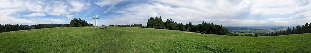
Panoramic view on the summit

View to the southwest and west to the Taunus

