Burst mill
|
Burst mill
Market Neualbenreuth
Coordinates: 49 ° 58 ′ 13 ″ N , 12 ° 26 ′ 41 ″ E
|
|
|---|---|
| Height : | 545 (539-553) m above sea level NN |
| Residents : | 24 (1987) |
| Postal code : | 95698 |
| Area code : | 09638 |
|
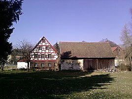
Platzermühle, view from the south (2014)
|
|
The Platzermühle is a district of the market Neualbenreuth in the Upper Palatinate district of Tirschenreuth .
geography
The hamlet is located one kilometer southwest of the historic Neualbenreuther market square in the valley of the Pfarrbühlbach . This flows into the Muglbach 400 m northwest . Naturally, Platzermühle is located in the Upper Palatinate Forest . The Naab-Wondreb Depression extends to the north and west, and the state border with the Czech Republic runs three kilometers to the east .
history
The area was not permanently settled until the end of the 12th century due to its altitude, climatic and barren soil conditions. After uncertain fates in the late Middle Ages , only the “Försterhaus”, also called “Egerer Forsthaus”, from 1802, which is a listed building, has been preserved. See also the list of architectural monuments in Platzermühle
The Bavarian original cadastre contains Platzermühle in the 1810s as a hamlet with three hearths next to the eponymous mill and the mill pond .
The place is still predominantly agricultural and forestry. Only two properties have been added on the southern edge and the campsite in the northeast, which also brings some tourism to the area.
traffic
The state roads St 2174 and 2175 connect Platzermühle with Neualbenreuth and other surrounding towns. The local public transport supplies the place with two bus lines.

