Pogórze Wielickie
| Pogórze Wielickie | ||
|---|---|---|
|
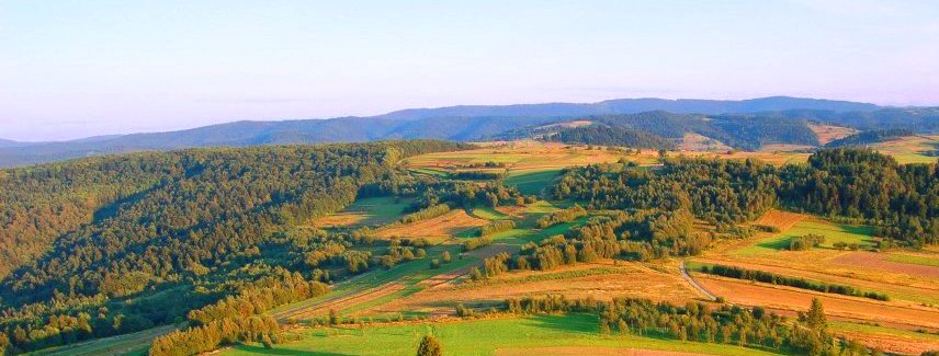
View of the mountains from Wartenberg Castle in Krakow |
||
| Highest peak | Barnasiówka ( 566 m npm ) | |
| location | Poland | |
| part of | West Beskids | |
|
|
||
| Coordinates | 49 ° 50 ′ N , 19 ° 53 ′ E | |

The Pogórze Wielickie consists of foothills of the West Beskids in southern Poland in the Lesser Poland Voivodeship . Its highest peak is the Barnasiówka with 566 m. The mountain range is named after the city of Wieliczka ( German Groß Salze ).
geography
The mountains border in the north on the Auschwitz Basin and the Cracow Gate , in the south on the Makower Beskids and Lesser Beskids, in the southeast on the Wiśnicz Mountains and in the west on the Silesian Foothills . It lies between the Wieprzówka rivers in the west and Raba in the east.
structure
The 55 km long and 15 km wide mountain range is divided into the ridges:
- Barnasiówka Comb ( Pasmo Barnasiówki )
- Bukowiec Comb ( Pasmo Bukowca )
Cities
The cities in Pogórze Wielickie are Krakow , Wieliczka and Myślenice .
heritage Site
In Lanckorona the ruins of are Castle Lanckorona received.
In Kalwaria Zebrzydowska there is a calvary with a monastery, which is a UNESCO World Heritage Site.
natural reserve
The southern part of the mountain lies in the Pogórze Wiśnickie Nature Park .
proof
- Jerzy Kondracki: Geografia regionalna Polski. Warszawa: Wyd. Naukowe PWN, 1998. ISBN 83-01-12479-2 .
Left
See also
panorama


