Polvijärvi
| coat of arms | map |
|---|---|

|

|
| Basic data | |
| State : |
|
| Landscape : | North Karelia |
| Administrative community : | Joensuu |
| Geographical location | 62 ° 51 ′ N , 29 ° 22 ′ E |
| Surface: | 958.38 km² |
| of which land area: | 804.16 km² |
| of which inland waterways: | 154.22 km² |
| Residents : | 4,307 (Dec. 31, 2018) |
| Population density : | 5.4 inhabitants / km² |
| Municipality number : | 607 |
| Language (s) : | Finnish |
| Website : | www.polvijarvi.fi |
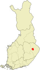
Polvijärvi [ ˈpɔlvijærvi ] is a municipality in eastern Finland with 4307 inhabitants (as of December 31, 2018). It is in the countryside of North Karelia 40 km north-west of Joensuu . The church village of Polvijärvi is located on an isthmus between the great lakes Viinijärvi and Höytiäinen . The municipality also includes the villages of Horsmanaho, Hukkala, Kinahmo, Kuorevaara, Martonvaara, Ruvaslahti, Sola and Sotkuma. Polvijärvi is dominated by agriculture and talc is also mined. One of the sights of the place is an Orthodox wooden church from 1913, which is consecrated to John the Baptist .
In 1854 Lake Höytiäinen was lowered by the construction of a canal to Pyhäselkä, 21 meters lower . This gained 157 km² of new land that could be used for agriculture.
Sons and daughters
- Urpo Leppänen (1944-2010), politician
- Reetta Meriläinen (* 1950), formerly editor-in-chief of Helsingin Sanomat
- Laura Toivanen (* 1988), biathlete
Web links
Individual evidence
- ↑ Maanmittauslaitos (Finnish land surveying office): Suomen pinta-alat kunnittain January 1, 2010 . (PDF; 199 kB)
- ↑ Statistical Office Finland: Table 11ra - Key figures on population by region, 1990-2018