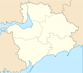
Prymorske (Wassyliwka)
| Prymorske | ||
| Приморське | ||

|
|
|
| Basic data | ||
|---|---|---|
| Oblast : | Zaporizhia Oblast | |
| Rajon : | Vasylivka district | |
| Height : | 73 m | |
| Area : | 54.6 km² | |
| Residents : | 3,692 (2017) | |
| Population density : | 68 inhabitants per km² | |
| Postcodes : | 71615 | |
| Area code : | +380 6175 | |
| Geographic location : | 47 ° 37 ' N , 35 ° 17' E | |
| KOATUU : | 2320985501 | |
| Administrative structure : | 1 village | |
| Address: | вул. 50-річчя Жовтня 219 71 615 с. Приморське |
|
| Website : | City council website | |
| Statistical information | ||
|
|
||
Prymorske ( Ukrainian Приморське ; Russian Приморское Primorskoje ) is a village in the Ukrainian Oblast of Zaporizhia with about 3700 inhabitants (2017).
The village, founded in 1750 as Tsar-Kut ( Цар-Кут ), was given its current name in 1964. Prymorske is the only village in the district council of the same name in Vasylivka district .
Prymorske lies at the mouth of the Kinska in the Dnepr , which is dammed up to the Kachowka reservoir , opposite the urban-type Malokaterynivka settlement . In the south the village borders on the urban-type Stepnohirsk settlement . The Vasylivka district center is 30 km south and the Zaporizhia Oblast center 30 km north of Prymorske.
Web links
- Prymorske on the Rajon Administration website (Ukrainian)
Individual evidence
- ↑ a b Website of the village on the website of the Zaporizhia Oblast , accessed on September 5, 2017 (Ukrainian)

