Puerto Esperanza (Ucayali)
| Puerto Esperanza | ||
|---|---|---|
|
|
||
| Coordinates | 9 ° 46 ′ S , 70 ° 43 ′ W | |
| Basic data | ||
| Country | Peru | |
| Ucayali | ||
| province | Purus | |
| ISO 3166-2 | PE-UCA | |
| District | Purus | |
| height | 221 m | |
| Residents | 1229 (2017) | |
| politics | ||
| mayor | Empty Panduro Pérez (2019-2022) |
|
Puerto Esperanza (or Esperanza ) is the capital of the Purús Province in the Ucayali region of eastern Peru . The small town is the administrative seat of the Purús district , which is congruent with the province. The 2017 census counted 1,229 inhabitants, 10 years earlier the population was 1251.
Geographical location
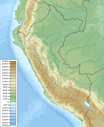
The city of Puerto Esperanza is located at an altitude of 221 m in the Amazonian lowlands of Peru on the right bank of the Río Purús . The city is located about 750 km east-northeast of the state capital Lima, about 10 km from the Brazilian border. The Aeródromo de Puerto Esperanza airport ( ICAO code: SPEP) is located in Puerto Esperanza . The Alto Purús National Park is nearby .
population
The region's population consists of 80% indigenous people, as well as mostly poor settlers from other regions of Peru.
living conditions
Puerto Esperanza is not connected to the road network. The city can only be reached from Peru by plane; Also via the rivers, which are important as a traffic route in the Amazon region, only the neighboring Brazil can be reached, but not other Peruvian cities, as the Río Purús and its tributaries come from an unpopulated area southwest of the city. There are also complaints on site that there is only electricity for a few hours a day and no internet connection. The seclusion is reflected in high prices for food and consumer goods that are not produced on site. Poor health care leads to widespread diseases such as parasite infestation.
Conflict over a possible road connection
In order to improve the traffic connection, part of the population is demanding a road to Iñapari , called multimodal . However, this would inevitably lead through the Alto Purús National Park and thus also be a gateway for illegal activities in it. The national park includes one of the areas with the greatest biodiversity and also isolated peoples who are to be protected from diseases and other external influences. Some residents began to cut a swath in the forest with machetes in 2013, but were stopped after 22 km.
While, according to the Society for Threatened Peoples, the indigenous population is largely against the construction of the road, the colonos - settlers who have moved in - and the local priest are campaigning for the construction of the road.
Individual evidence
- ↑ Peru: Ucayali Region - Provinces & Places . www.citypopulation.de. Retrieved January 16, 2020.
- ↑ a b [CRÓNICA La disyuntiva de Purús entre la conexión o la conservación]
- ^ The "Road of Death" , Society for Threatened Peoples
