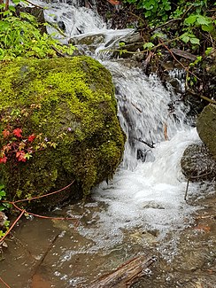
Quirinbach
| Quirinbach | ||
|
Quirinbach |
||
| Data | ||
| location | Miesbach district | |
| River system | Danube | |
| Drain over | Tegernsee → Mangfall → Inn → Danube → Black Sea | |
| source | East of Sankt Quirin 47 ° 43 ′ 36 " N , 11 ° 45 ′ 38" E |
|
| Source height | 1100 m above sea level NN | |
| muzzle | At Sankt Quirin in the Tegernsee Coordinates: 47 ° 43 '29 " N , 11 ° 44' 42" E 47 ° 43 '29 " N , 11 ° 44' 42" E |
|
| Mouth height | 726 m above sea level NN | |
| Height difference | 374 m | |
| Bottom slope | approx. 29% | |
| length | approx. 1.3 km | |
| Communities | Gmund am Tegernsee | |
The Quirinbach is a brook in Upper Bavaria that flows into the Tegernsee . The Quirinbach rises to the west below the Neureuth . After crossing the tracks and the federal highway 307 near Sankt Quirin , it flows into the Tegernsee.
