
Río Márquez
| Río Márquez | ||
 Alluvial plain of the Río Márquez |
||
| Data | ||
| location | Bolivia | |
| River system | Altiplano | |
| source |
Municipio Uyuni 19 ° 30 ′ 0 ″ S , 66 ° 22 ′ 38 ″ W |
|
| Source height | 4496 m | |
| muzzle |
Lake Poopó coordinates: 19 ° 9 ′ 54 ″ S , 67 ° 1 ′ 16 ″ W 19 ° 9 ′ 54 ″ S , 67 ° 1 ′ 16 ″ W. |
|
| Mouth height | 3686 m | |
| Height difference | 810 m | |
| Bottom slope | 5.4 ‰ | |
| length | 150 km | |
| Left tributaries | Mulato River | |
| Right tributaries | Río Challahuiri, Río Kakena, Río Jachcha Laca, Río Coroma | |
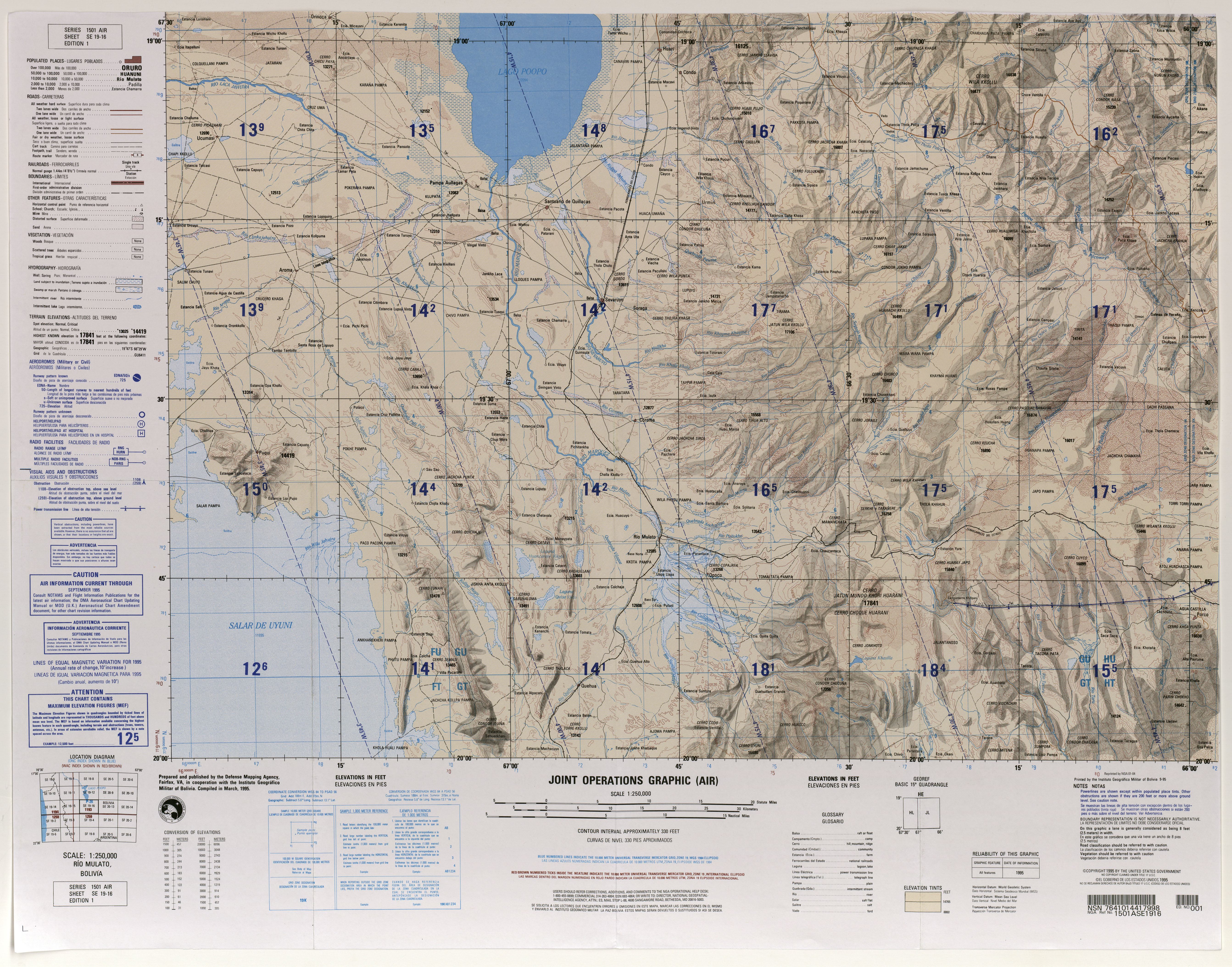
The Río Márquez is a river in the departments of Potosí and Oruro in the highlands of the South American Andean state of Bolivia .
The Río Márquez rises as Río Huaña Jápo , also: Río Huayña Jápo , in the eastern part of the Cordillera de los Frailes ridge in the municipality of Uyuni in the province of Antonio Quijarro in the Department of Potosí. For the first 100 kilometers it flows in a westerly direction and bears the name Río Molino in the middle reaches . As the Río Márquez , it joins the Río Mulato and then turns north, in the lower reaches the river also bears the name Río Anta . After a total of 150 kilometers, the river reaches Lake Poopó on its south bank in the municipality of Pampa Aullagas in the Ladislao Cabrera province in the Oruro department.
Web links
- Raised relief map Rio Mulato, Bolivia 1: 100,000 (PDF; 9.2 MB)
- Abraham Ender: Explotación de Uranio en Bolivia? (PDF; 586 kB)
- Río Marquez