
Roman Celtic Path
| Roman Celtic Path | |
|---|---|

|
|
| length | 13.1 km |
| Level of difficulty | medium |
| Ascent | 409 m |
| descent | 409 m |
| Duration | 3 to 3.5 hours |
| Lowest point | 367 m |
| The highest point | 651 m |
| state | Rhineland-Palatinate |
| region | Hunsrück |
| Communities | Farschweiler , Lorscheid |
The Roman Celtic Path is a premium hiking trail and a so-called dream loop on the Saar-Hunsrück Steig in the Saar-Hunsrück Nature Park . It is located in the district of Trier-Saarburg in Rhineland-Palatinate and runs through the districts of Farschweiler and Lorscheid .
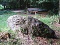
Special sights on the path, which mostly leads through meadows and forests, are the remains of a Roman aqueduct (at the Farschweiler sports field), a Roman well shaft , Celtic barrows , an early Celtic menhir , an educational forest trail , an old Roman road , restored stations of the cross , former mills and traces of former charcoal burning sites . In the spring of 2013, the trail was rated with 64 experience points by the German Hiking Institute .
The start and finish of the Roman Celtic Path is the Wallaby’s grill hut near Osburg-Sternfeld on Landesstrasse 151 (formerly Bundesstrasse 52 ).
The path first leads past the Linschköpfchen (451 meters above sea level) to the valley of the Lorscheider stream . There was the Spechtmühle and the path then leads to Lorscheid and over the Scholersmühle back to the Lorscheider Bach. On Bickenbach , we hike up toward the former. Refuge Three brands to the district boundaries of Beuren , Farschweiler and Osburg and from there back to the barbecue hut at Sternfeld.
photos
Menhir

Tumulus

Tumulus

View of Lorscheid


Web links
Individual evidence
- ^ Hans Nortmann: Altstrasse - Römerstrasse? In: Finds and excavations in the Trier district, 44-2012. ISSN 0723-8630. Rheinisches Landesmuseum Trier. ( PDF )
Coordinates: 49 ° 42 ′ 42.2 " N , 6 ° 49 ′ 27.7" E