Osburg
| coat of arms | Germany map | |
|---|---|---|

|
Coordinates: 49 ° 43 ' N , 6 ° 47' E |
|
| Basic data | ||
| State : | Rhineland-Palatinate | |
| County : | Trier-Saarburg | |
| Association municipality : | Ruwer | |
| Height : | 456 m above sea level NHN | |
| Area : | 32.92 km 2 | |
| Residents: | 2412 (Dec. 31, 2019) | |
| Population density : | 73 inhabitants per km 2 | |
| Postal code : | 54317 | |
| Area code : | 06500 | |
| License plate : | TR, SAB | |
| Community key : | 07 2 35 103 | |
| LOCODE : | DE OUR | |
| Association administration address: | Untere Kirchstrasse 1 54320 Waldrach |
|
| Website : | ||
| Mayoress : | Silvia Klemens (FWG) | |
| Location of the local community Osburg in the district of Trier-Saarburg | ||
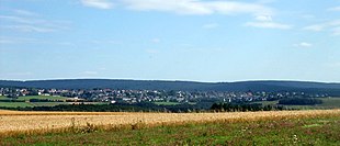
Osburg ( Moselle Franconian : Öhsborsch [ øːsboʁʃ , øːsborʃ ]) is a municipality in the district of Trier-Saarburg in Rhineland-Palatinate . It belongs to the Verbandsgemeinde Ruwer , which has its administrative headquarters in Waldrach .
geography
The community is located in the Osburger Hochwald recreation area and in the Saar-Hunsrück nature park near the Riveristal (and the Riveristalsperre ) between Trier and Hermeskeil in the Moselle-Franconian- speaking area.
The commercial and industrial area in the Neuhaus district is located on Landesstrasse 151 (formerly Bundesstrasse 52 ) near Osburg . The district of Forsthaus Sternfeld is also on the L 151.
On Rösterkopf springing Ruwer , a right tributary of the Mosel .
Surrounding communities are Waldrach , Thomm , Farschweiler , Beuren (Hochwald) , Reinsfeld , Kell am See , Holzerath , Bonerath and Riveris .
history
The area around Osburg was probably settled more than 2000 years ago, as evidenced by finds of objects and ground monuments, both of Roman and pre- / Celtic origin.
Between 1190 and 1200 the place was first handed down as Oysperg when the high forest was donated to the Archbishop of Trier by a royal donation .
In the Liber annalium iurium around 1212, the Hufen belonging to the archbishop, a mill and a parish church were mentioned for the place. In the 13th century the place appeared as Ozburc , Ozburch or Hozburch . An archbishop's court and the construction of a building for a courtier were mentioned in 1317.
The connection between the people Peter von Osburg and Colonel Jakob von Osburg with the place is unclear. Another Peter von Osburg , also called Johann Peter von Bernkastel , was a clergyman in St. Wendel from 1461–1464 .
Until the end of the 18th century, Osburg belonged to the Waldrach care in the Pfalzel office of the Electorate of Trier . After the occupation of the left bank of the Rhine by French revolutionary troops the place belonged 1798-1814 to Canton Hermeskeil in Saar department and came in 1815 due to the on the Congress of Vienna agreements made for the Kingdom of Prussia . In 1816 the community was assigned to the district of Trier and from 1822 it belonged to the Rhine province . Under the Prussian administration, Osburg belonged to the mayor's office in Farschweiler and later to the Waldrach office .
The forest hut settlements around the place were dissolved in the middle of the 19th century.
In 1893 the road between Waldrach and Hermeskeil via Hinkelhaus and Neuhaus was completed, in 1913 Osburg received water pipes and electricity.
In World War II the town was destroyed to about 60%. At the end of the Second World War in the upper Osburger Hochwald and in the Ruwertal , the book Fallen Fortresses was published in December 2016 . To the southeast of Osburg, near Landesstrasse 151, on the Grünbrücherschneise there is a bunker as part of the former West Wall .
At the end of the 20th century, several new development areas and the commercial and industrial area Osburg-Neuhaus were built .
For the first time in its history, Osburg presented the Ruwer wine queen in 2004/2006 as a "non-wine town" with Julia Bonert .
Population development
The development of the population of Osburg, the values from 1871 to 1987 are based on censuses:
|
|
Graphic of the population development

|
climate
The climate of Osburg and the entire Osburger Hochwald as part of the Hunsrück is oceanic . The summers are quite cool, the winters - compared to the low mountain ranges further to the east - rather mild, but due to the altitude and frequent rainfall in winter, quite snowy.
In summer, hot days with maximum daily temperatures of more than 30 ° C are quite rare in contrast to the nearby Moselle valley . Even summer days with a maximum temperature of 25 ° C and more are not common. Compared to basin and valley landscapes, Osburg is therefore significantly less humid and hot in summer. Hoar frost sometimes occurs in June and often again in September. Even in the high summer months of July and August, low temperatures of 5 ° C and below occur in Osburg. Snowfall or sleet must be expected even in May (e.g. on May 23, 2013) and again in October. It is quite windy all year round, with some severe storms in the winter months.
Statistical surveys from 2003 to 2015 have shown that the average temperature in Osburg, around 8 ° C, is around 3 ° C lower than in the lowlands of the Moselle valley. While the valleys of the Moselle, Saar and Ruwer are often shrouded in dense valley fog in autumn and winter, at the same time in Osburg, due to the altitude, there is often beautiful weather with a good view that extends north and north-west into the Eifel and into the Luxembourg-Belgian Ardennes ranges. Due to this inversion effect , the air at high altitudes is often particularly good and clear, which in the Hunsrück is recognized as being of high quality.
The amount of precipitation in Osburg with an average of approx. 1,060 liters per m² per year (average value 2003 to 2015) - as in the whole of the southwestern Hunsrück - is quite high. The amount of precipitation in the Osburger Hochwald is among the highest in Rhineland-Palatinate due to the pronounced windward location . Daily precipitation sums of 50 to 100 liters / m² can definitely occur (in Osburg e.g. 88.2 liters per m² within 24 hours on August 26th / 27th, 2010). The monthly rainfall in Osburg can be significantly more than 200 liters per m² (e.g. July 2014 with 237.4 liters per m²).
politics
Municipal council
Allocation of seats in the municipal council:
| choice | SPD | CDU | FWG | total |
|---|---|---|---|---|
| 2019 | 5 | - | 11 | 16 seats |
| 2014 | 5 | 2 | 9 | 16 seats |
| 2009 | 5 | 3 | 8th | 16 seats |
| 2004 | 4th | 3 | 9 | 16 seats |
- FWG = Free Voters Group Osburg e. V.
Local mayor
- Hans Rausch, CDU, until 1984
- Werner Mergens, FWG, 1984 to 2011, holder of the Federal Order of Merit
- Hubert Rommelfanger, FWG, 2012 to 2017
- Klaus Bauer, SPD, 2017 to 2019
- Silvia Klemens, FWG, from 2019
coat of arms
| Blazon : “The shield is divided and split in the upper half. A red bar cross in silver at the top right . At the top left, in blue, a silver castle with a tower. Below in gold a green three-mountain with three green fir trees. " | |
| Justification of the coat of arms: The red cross in silver is the heraldic symbol of the Archdiocese and Electoral State of Trier , to which Osburg belonged from the Middle Ages to the end of the 18th century. The castle is reminiscent of the former Osburg castle, the tower of which has been preserved in this form as the tower of the modern parish church. The Dreiberg with the firs indicates the scenic location of Osburg in the Trier high forest . |
Partner municipality
Culture and sights
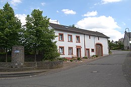
The medieval round tower serves as the church's bell tower.
More than 20 clubs are active in various areas of society. The trade association Osburger Hochwald e. V., based in Osburg, existed from 2002 to 2018 and held several trade shows in the Osburg-Neuhaus commercial and industrial area . The Osburger Dorf- und Heimatfest achieved supraregional importance through the appearance of internationally known performers.
- See also
media
Local media are the Trierische Volksfreund , the Mosel-Ruwertaler Wochenspiegel and the official gazette of the Verbandsgemeinde Ruwer .
Economy and Infrastructure
Near Osburg-Neuhaus is a 380- kilovolt - substation , it is operated by Amprion GmbH. The system is part of the European high voltage network and is used to supply the Trier area. See also: List of switchgear in the extra high voltage network in Germany # Rhineland-Palatinate .
Public facilities
- School, kindergarten, fire station, fairground, sports field, tennis courts, club house, parsonage
- Osburger Hochwaldhalle
Personalities
- Wilhelm Becker (1913–1994), Düsseldorf automobile dealer
- Regine Barbie born Willms (1915–1982), wife of the SS war criminal Klaus Barbie
- Hans-Peter Dellwing (* 1950), soccer referee
- Kristina Krewer (* 1989), bowling athlete
literature
- Tobias Blasum / Hermann Bonert, Fallen Fortresses. The end of the Second World War in the Osburger Hochwald and Ruwertal , Kieselkaul-Verlag, Osburg 2016, 541 pages. ISBN 978-3-00-054815-4 .
- Ewald Wegner (arrangement): District of Trier-Saarburg. Verbandsgemeinden Ruwer, Schweich, Trier-Land (= monument topography Federal Republic of Germany , cultural monuments in Rhineland-Palatinate . Volume 12.2 ). Wernersche Verlagsgesellschaft, Worms 1994, ISBN 3-88462-110-6 , p. 96-97 .
Web links
- Osburg community
- Link catalog on Osburg at curlie.org (formerly DMOZ )
- Manfred Bales: Moselle Franconian Dictionary. (Private website).
Individual evidence
- ↑ State Statistical Office of Rhineland-Palatinate - population status 2019, districts, communities, association communities ( help on this ).
- ↑ State Statistical Office Rhineland-Palatinate (ed.): Official directory of the municipalities and parts of the municipality. Status: January 2019 [ Version 2020 is available. ] . S. 119 (PDF; 3 MB).
- ↑ Catholic parish of St. Wendelin
- ↑ State Statistical Office Rhineland-Palatinate: Regional data.
- ↑ Source: Jörg Peter Steinmetz's private weather site, Osburg
- ^ The Regional Returning Officer Rhineland-Palatinate: Local elections, city and municipal council elections
- ^ Trierischer Volksfreund
- ↑ Result of the local mayor election Osburg 2017
- ^ Report in the Trierisches Volksfreund
- ↑ Source: Holocaust Research Project, accessed on July 19, 2016
- ↑ gefallene-festungen.de


