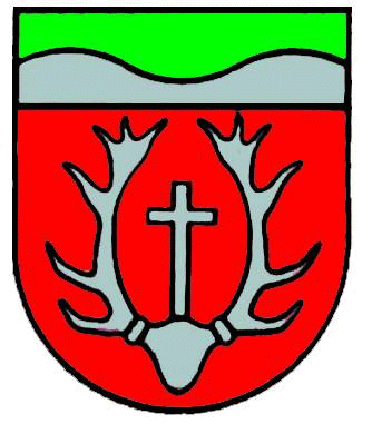
Zerf
| coat of arms | Germany map | |
|---|---|---|

|
Coordinates: 49 ° 36 ' N , 6 ° 41' E |
|
| Basic data | ||
| State : | Rhineland-Palatinate | |
| County : | Trier-Saarburg | |
| Association municipality : | Saarburg-Kell | |
| Height : | 340 m above sea level NHN | |
| Area : | 28.87 km 2 | |
| Residents: | 1522 (Dec. 31, 2019) | |
| Population density : | 53 inhabitants per km 2 | |
| Postal code : | 54314 | |
| Area code : | 06587 | |
| License plate : | TR, SAB | |
| Community key : | 07 2 35 152 | |
| Community structure: | 3 districts | |
| Association administration address: | Schlossberg 6 54439 Saarburg |
|
| Website : | ||
| Local Mayor : | Rainer Hansen ( CDU ) | |
| Location of the local community Zerf in the district of Trier-Saarburg | ||
Zerf is a municipality in the Trier-Saarburg district in Rhineland-Palatinate . It belongs to the Saarburg-Kell association. Zerf is a state-approved resort and is designated as a basic center according to state planning .
geography
Zerf is located on the Großbach and the Ruwer in the Saar-Hunsrück nature park in a wooded altitude. At Zerf, the Ruwer-Hochwald-Radweg runs along the route of the former Hochwaldbahn .
The community is divided into the three districts Niederzerf , Oberzerf and Frommersbach . Zerf also includes the Zerf train station , Rübezahl campsite, Dürrwiese, Forsthaus Zerf, Hirschfelderhof, Kalfertshaus and Konzbachhof residential areas .
history
Finds are bronze vessels and gold jewelry of Etruscan origin from the Zerfer prince's grave and ruins of former country houses ( villa rusticas ) from Roman times as well as Roman coins, jewelry, weapons and other implements.
In the false document of Charlemagne from 802, Zerf Cervia is mentioned. The St. Paulin Abbey in Trier was the largest landlord in Zerf until 1802. In 1816 Zerf came to Prussia with its own mayor's office .
- Population development
The development of the population of Zerf, the values from 1871 to 1987 are based on censuses:
|
|
Municipal council
The local council in Zerf consists of 16 council members, who were elected in a personalized proportional representation in the local elections on May 26, 2019 , and the honorary local mayor as chairman.
The distribution of seats in the local council:
| choice | SPD | CDU | FBL | BOK | GFZ | NLZ | total |
|---|---|---|---|---|---|---|---|
| 2019 | 3 | 8th | - | - | 3 | 2 | 16 seats |
| 2014 | 5 | 4th | 2 | 2 | 3 | - | 16 seats |
| 2009 | 6th | 6th | 2 | 2 | - | - | 16 seats |
| 2004 | 5 | 6th | 3 | 2 | - | - | 16 seats |
- FBL = Free Citizens List Zerf e. V.
- BOK = Citizens' Union for Open Local Policy V.
- GFZ = Together for Zerf e. V.
- NLZ = New List Zerf e. V.
Culture and clubs
Numerous clubs are active in various areas of society.
Economy and Transport
The federal highways 268 and 407 ( Hunsrückhöhenstraße ) cross near Zerf .
Public facilities
- Ruwertalhalle with youth room
- primary school
- kindergarten
See also
literature
- Ernst Wackenroder : The art monuments of the Saarburg district . (= Paul Clemen (Hrsg.): Die Kunstdenkmäler der Rheinprovinz , Volume 15, III. Department). L. Schwann, Düsseldorf 1939 (reprint of the Academic Bookshop Interbook, Trier 1982), pp. 294–298.
Web links
- Local community Zerf on the website of the Saarburg-Kell association
- To search for cultural assets of the local community Zerf in the database of cultural assets in the Trier region .
- Link catalog on the subject of Zerf at curlie.org (formerly DMOZ )
Individual evidence
- ↑ State Statistical Office of Rhineland-Palatinate - population status 2019, districts, communities, association communities ( help on this ).
- ↑ a b State Statistical Office Rhineland-Palatinate - regional data
- ↑ State Statistical Office Rhineland-Palatinate (ed.): Official directory of the municipalities and parts of the municipality. Status: January 2019 [ Version 2020 is available. ] . S. 126 (PDF; 3 MB).
- ↑ Engelbert Mühlbacher with the participation of Alfons Dopsch , Johann Lechner and Michael Tangl (eds.): Diplomata 4: The documents of Pippin, Karlmann and Charlemagne (Pippini, Carlomanni, Caroli Magni Diplomata). Hanover 1906, pp. 391–393 ( Monumenta Germaniae Historica , digitized version )
- ^ The Regional Returning Officer Rhineland-Palatinate: Local elections 2019, city and municipal council elections
- ^ Associations in Zerf


