
Hedgehog (mosel)
| coat of arms | Germany map | |
|---|---|---|

|
Coordinates: 49 ° 43 ' N , 6 ° 33' E |
|
| Basic data | ||
| State : | Rhineland-Palatinate | |
| County : | Trier-Saarburg | |
| Association municipality : | Trier country | |
| Height : | 164 m above sea level NHN | |
| Area : | 7.3 km 2 | |
| Residents: | 2089 (Dec. 31, 2019) | |
| Population density : | 286 inhabitants per km 2 | |
| Postal code : | 54298 | |
| Area code : | 06501 | |
| License plate : | TR, SAB | |
| Community key : | 07 2 35 051 | |
| Community structure: | 2 districts | |
| Association administration address: | Gartenfeldstrasse 12 54295 Trier |
|
| Website : | ||
| Local Mayor : | Franz Pauly ( CDU ) | |
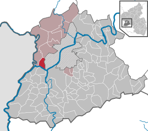
| Location of the local community Igel in the Trier-Saarburg district | ||
  |
||


Igel is a municipality in the Trier-Saarburg district in Rhineland-Palatinate . It belongs to the Trier-Land community . Historically and visually outstanding monument is a Roman tomb, the Igel column .
geography
location
Igel is located on the left bank of the Moselle west of Trier near the border with Luxembourg , immediately downstream of the confluence of the German-Luxembourg border river Sauer also on the left and a good kilometer upstream of the confluence of the Saar on the opposite bank of the Moselle. A geological peculiarity is the Igeler fault , a tectonic shift of red sandstone and limestone cliffs on the "Igeler Berg". It continues across the Moselle and can be easily observed from the “Liescher Berg” opposite .
Community structure
The community is divided into two districts and a number of places to live (population on May 1, 2016):
| District | Associated living spaces | Residents |
|---|---|---|
| Hedgehog | House Schau ins Land, Heintzhof, Löwener Mühle | 1,807 |
| Liersberg | 294 |
Surname
Historical forms of the name documented in the sources include Agullia (929), Egela (1052–1145), Egla (1052–1195), Egele (12th century), Egle (1220–1515), Egel (1400–1648), Egell (458–1541), Eggel (1501–1528), Eegel (around 1540) and finally the hedgehog, which is still used today.
According to a widespread view, the place name Igel is derived from the eagle figure ( eagle = Latin aquila , French aigle , English eagle [iːɡɫ]), which adorned the top of the Igel column as a symbol of the Roman god Jupiter and from which it still is remains are preserved today. This theory was advocated as early as 1512 by the humanist Willibald Pirckheimer . The art historian Eberhard Zahn, on the other hand, traced the name hedgehog back to the Middle Latin word "agulia" (compare the French aiguille = needle ), the medieval name for the obelisk in Rome. Both variants relate the place name to the most striking building in the settlement, the Igel column. Proponents of both theories also suspect a connection (e.g. in the form of a common origin) between the name Igel and the term Eigelstein , which was used to describe towering ancient grave monuments, often crowned with eagles, especially in the Rhineland.
A third hypothesis, on the other hand, derives the name hedgehog from the Celtic or Celto-Roman name Aquila / Aquela for a flowing body of water, which is said to refer to the stream through the place and from which the current form developed via the early name forms Agullia and Egela.
history
After the conquest of the country of Gaul (58–51 BC) and the area of the Celtic Treveri (around 50 BC), the Trier region remained under Roman rule until around 450 AD. During this period, Igel emerged from a settlement near the villa of the family of cloth manufacturers and large landowners, the Secondinians. The property has not yet been explored.
There is a district "Königsacht", where the new building area "Am Deibach" is today. The current railway site, which has been heaped up to 5 m, was part of the “King's Night” before the railway was built. Nothing was found during the construction work “Am Deibach” for sewer, electricity, gas and cellar; Investigations in the station area remain open . The question of why this area is called “King's Eight” is still unanswered.
Further west, near the Löwener Mühle in the vineyards, several Roman coins were found. Investigations on and under the " Igel Column ", the tomb of the Secondiners, in 1911 have shown that there is no burial chamber under or near the monument. About 1.6 km further west of the tomb, however, there is a Roman burial chamber, which is popularly known as "the Grutenhäuschen " (Grut = grotto). It was restored on the remains of the original burial chamber in 1962 by the State Museum in Trier. In 2001, the upper and front parts of the original temple were reconstructed so that visitors can see it today as it originally looked.
Around 275/276, Igel, like many other towns and villages in the area, was probably reduced to rubble during the raids of the Alemanni and Franks .
Around 700 the Frankish King Childerich III. under the housekeeper Pippin von Heristal (678-714) the Archbishop Lutwinus (695-713) in Trier his property, the former Secundinier estate in Igel. A church dedicated to St. Dionysius was probably built in Igel around this time.
On the Easter days of the year 882, the city of Trier and the surrounding countryside, including Igel, were plundered and devastated again during the second Norman invasion. The Igel column survived this Norman storm. However, it was already damaged in the Middle Ages when the iron clips were torn out.
Igel was first mentioned in a document in 929. It is a deed of gift from a certain Megingaud, who bequeathed three Hufen land, vineyards and accessories in "Villa Aguilla" to the Trier Abbey of St. Maximin.
The old parish church was built around 1250 on the site of the church that was built around 700. She was dedicated to St. Dionysius consecrated because the place is in possession of a relic of him. This saint is also the patron saint of the community.
In 1712 the choir and nave fell into disrepair, in 1756 the church was just a ruin. In 1759/1760 it was rebuilt using the Romanesque tower of the original building. In 1953/1954 the new parish church was built.
From 1912 until it was destroyed in 1945, a railway bridge, unofficially known as the Hindenburg Bridge, spanned the Moselle near Igel , built to relieve the older and still existing Konz Moselle Bridge below the mouth of the Saar.
On March 16, 1974, the previously independent community of Liersberg was incorporated into Igel.
- Population development
The development of the population of Igel in relation to today's municipal area; the values from 1871 to 1987 are based on censuses:
|
|
Municipal council
- igelplus : 2
- FWG Kömen : 4
- FWG Grundhöfer : 4
- CDU : 6
The local council in Igel consists of 16 council members, who were elected in a personalized proportional representation in the local elections on May 26, 2019 , and the honorary local mayor as chairman. In 2019 Franz Pauly (CDU) was elected local mayor.
The distribution of seats in the local council:
| choice | SPD | CDU | WGR Sharp cheap | WGR Kömen | WGR Grundhöfer | igelplus | total |
|---|---|---|---|---|---|---|---|
| 2019 | - | 6th | - | 4th | 4th | 2 | 16 seats |
| 2014 | 3 | 7th | 6th | - | - | - | 16 seats |
| 2009 | 2 | 9 | 5 | - | - | - | 16 seats |
| 2004 | 4th | 7th | 5 | - | - | - | 16 seats |
Culture and sights

Igel is known for the famous Igel column . This monument from the Roman period is an approximately 23 meter high grave monument made of red sandstone. The Secundinier family of cloth merchants and large landowners had it built in the middle of the 3rd century.
It is exactly 9 km from the Roman bridge in Trier. This is also evident from the inscription "L IIII", which can be found on the columnar milestone in the relief in the attic on the west side of the monument (in the middle of the background of the carriage drawn by two horses). "L IIII" means "Leugae quattuor" = 4 Leugen = 4 Gallic miles = approx. 9 km. It did not fall victim to destruction in the Middle Ages, as the group of three figures on the front was believed to represent the marriage of the Roman Emperor Constantius Chlorus to Flavia Iulia Helena Augusta , parents of Constantine the Great .
In the Rheinisches Landesmuseum in Trier there is a copy of the original in the inner courtyard, which was provided with the original painting. The Igel Column is part of the UNESCO World Heritage Site Roman Monuments, Cathedral and Church of Our Lady in Trier and is the oldest Roman monument of its kind north of the Alps.
Another attraction is the Romanesque court arbor (stone arbor or "Pützhaus"), in which the sessions of the Igel jury and the court hearings took place.
See also: List of cultural monuments in Igel
societies
The Igel volunteer fire brigade provides fire protection and general help not only at the local level, but also in Langsur and Zewen .
There is also a music club (MV Lyra Igel 1909 eV), a carnival club (ICV) and various sports clubs.
traffic

Street
The place is on the federal highway 49 , which ends a few kilometers further in Wasserbilligerbrück on the Luxembourg border.
Igel is connected to the Trier city bus network every 20 minutes - every hour in the evenings and on weekends .
rail
Igel has a train station along the Mosel-Syretal route ( KBS 693 ). The SÜWEX line RE 11 runs there (Koblenz Hbf - Cochem (Mosel) - Bullay - Wittlich - Trier Hbf - Wasserbillig - Sandweiler-Contern - Luxemburg-Gare). The Trier western route branches off between Igel and the Moselle Bridge , on which there is no passenger traffic. Until 1968 Igel was the start and destination station of the Nims-Sauertalbahn Erdorf - Irrel - Igel (- Trier-West). From 1912 until it was destroyed in 1945, a railway bridge called the Hindenburg Bridge crossed the Moselle near Igel .
literature
- Franziska Kandel: Family Book St. Dionysius Wasserliesch 1706–1899. (private, 1994)
- H. Wurringen: family book of the cath. Parish Igel 1706–1798. (private, 1939)
Web links
- Internet presence of the local Igel community
- To search for cultural assets of the local community Igel in the database of cultural assets in the Trier region .
- Link catalog on hedgehogs at curlie.org (formerly DMOZ )
Individual evidence
- ↑ State Statistical Office of Rhineland-Palatinate - population status 2019, districts, communities, association communities ( help on this ).
- ↑ State Statistical Office Rhineland-Palatinate (ed.): Official directory of the municipalities and parts of the municipality. Status: January 2018 [ Version 2020 is available. ] . S. 79 (PDF; 2.2 MB).
- ↑ Residents with main residence as of May 1, 2016, population statistics of the Trier-Land municipality ( Memento from May 11, 2016 in the Internet Archive )
- ↑ Aloys Leonardy: Igel, Under the shadow of the eagle's wings. 1972, OCLC 749980125 .
- ^ Willibald Pirckheimer: Opera politica, historica, philologica et epistolica. Fischer, Frankfurt am Main 1610, p. 94 (digitized version) . Dating to 1512 according to Jacques Mersch: La Colonne d'Igel. Essai historique et iconographique / The monument of the hedgehog. Historical-iconographic study (= Publications Mosellanes. Volume 24). Les Publications Mosellanes, Luxemburg 1985, p. 21.
- ↑ Eberhard Zahn: The Igel column in Igel near Trier. 5th edition. Neusser Druckerei und Verlag, Neuss 1982, ISBN 3-88094-425-5 , p. 35.
- ^ Franz Cramer : Rhenish place names from pre-Roman and Roman times. E. Lintz, Düsseldorf 1901, p. 151 f. (Digitized version)
- ↑ www.eifel.de: Grutenhäuschen, Igel-Liersberg , accessed on December 14, 2008.
- ↑ Official municipality directory (= State Statistical Office of Rhineland-Palatinate [Hrsg.]: Statistical volumes . Volume 407 ). Bad Ems February 2016, p. 167 (PDF; 2.8 MB).
- ↑ State Statistical Office Rhineland-Palatinate - regional data
- ↑ State Statistical Office of Rhineland-Palatinate - population status 2019, districts, communities, association communities ( help on this ).
- ^ The Regional Returning Officer Rhineland-Palatinate: Local elections 2019, city and municipal council elections
- ↑ Query of the course book route 693 at Deutsche Bahn.

Aach | Ayl | Baldringen | Bekond | Notification | Beuren (high forest) | Bonerath | Damflos | Detzem | Ensch | Farschweiler | Fur | Fish | Pine | Franzenheim | Freudenburg | Geisfeld | Greimerath | Grimburg | Gusenburg | Gusterath | Gutweiler | Heddert | Stalling | Herl | Hermeskeil | Hinzenburg | Hinzert-Pölert | Hockweiler | Holzerath | Hedgehog | Irsch | Kanzem | Chasuble | Kastel-Staadt | Kell am See | Kenn | Kirf | Klüsserath | Conc | Cord | Korlingen | Köwerich | Lampades | Langsur | Leiwen | Lunge | Longuich | Lorscheid | Mandern | Mannebach | Mehring | Mertesdorf | Merzkirchen | Morscheid | Naurath (Eifel) | Naurath (forest) | Neuhütten | Newel | Nittel | Upper cheap | Ockfen | Ollmuth | Onsdorf | Osburg | Palzem | Paschel | Pellingen | Pluwig | Pölich | Ralingen | Swift oath | Reinsfeld | Riol | Riveris | Saarburg | Schillings | Schleich | Schoden | Schömerich | Schondorf | Schweich | Serrig | Sommerau | Taben-Rodt | Tawern | Temmels | Thomm | Thörnich | Trassem | Trierweiler | Trittenheim | Vierherrenborn | Waldrach | Waldweiler | Wasserliesch | Wawern | Waves | Welschbillig | Wiltingen | Wincheringen | Zemmer | Zerf | Züsch