Lunge
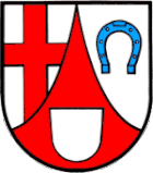
| coat of arms | Germany map | |
|---|---|---|

|
Coordinates: 49 ° 48 ' N , 6 ° 47' E |
|
| Basic data | ||
| State : | Rhineland-Palatinate | |
| County : | Trier-Saarburg | |
| Association municipality : | Schweich on the Roman Wine Route | |
| Height : | 129 m above sea level NHN | |
| Area : | 0.97 km 2 | |
| Residents: | 114 (Dec. 31, 2019) | |
| Population density : | 118 inhabitants per km 2 | |
| Postal code : | 54338 | |
| Area code : | 06502 | |
| License plate : | TR, SAB | |
| Community key : | 07 2 35 077 | |
| LOCODE : | DE ONG | |
| Association administration address: | Brückenstrasse 26 54338 Schweich |
|
| Website : | ||
| Local Mayor : | Hermann Rosch | |
| Location of the local community Longen in the district of Trier-Saarburg | ||
Longen an der Mosel is a municipality in the Trier-Saarburg district in Rhineland-Palatinate . It belongs to the Verbandsgemeinde Schweich on the Roman Wine Route .
Longen lies at the foot of the Mehringer mountain , at 418.7 m above sea level. NHN one of the highest elevations in the Moselle mountains .
history
In 770, the Luxembourg Abbey of Echternach was assigned properties in "Longun". From this, the Prüm Abbey acquired the place, which was now called "Longin", in 830 and sold it in 1343 to Archbishop Balduin von Trier for 350 shield guilders and 100 pounds of Trier pfennigs .
Until the end of the 18th century Longen belonged to the Electorate of Trier ( Pfalzel Office , Schweich care ). By 1790 Longen had nine houses.
- Statistics on population development
The development of the population of Longen, the values from 1871 to 1987 are based on censuses:
|
|
politics
Municipal council
The local council in Longen consists of six council members, who were elected in a personalized proportional representation in the local elections on May 26, 2019 , and the honorary local mayor as chairman.
Attractions
The chapel of St. Eligius with hall from 1495 is of Gothic origin and shows structural details and furnishings from the period of construction that have been preserved. It is one of the oldest chapels in the Diocese of Trier in Gothic style. It is located in the center of the village and, together with the Brunnenplatz, forms the starting point for the large network of hiking trails. The Landwehr Cross is located at the boundary between Schweich / Mehring / Longen .
See also: List of cultural monuments in Longen
societies
The Longen farmers and winemakers ' association represents the interests of the local farmers and winemakers . There is also the Longener Kulturverein eV
Public facilities
The place has a volunteer fire brigade .
Vineyards
- Zell mountain
Web links
- Local community Longen on the website of the Verbandsgemeinde Schweich
- Link catalog on the topic of lounging at curlie.org (formerly DMOZ )
- To search for cultural assets of the local community Longen in the database of cultural assets in the Trier region .
Individual evidence
- ↑ State Statistical Office of Rhineland-Palatinate - population status 2019, districts, communities, association communities ( help on this ).
- ↑ State Statistical Office Rhineland-Palatinate - regional data
- ^ The Regional Returning Officer Rhineland-Palatinate: Local elections 2019, city and municipal council elections


