
Tawern
| coat of arms | Germany map | |
|---|---|---|

|
Coordinates: 49 ° 40 ′ N , 6 ° 31 ′ E |
|
| Basic data | ||
| State : | Rhineland-Palatinate | |
| County : | Trier-Saarburg | |
| Association municipality : | Conc | |
| Height : | 210 m above sea level NHN | |
| Area : | 10.12 km 2 | |
| Residents: | 2647 (Dec. 31, 2019) | |
| Population density : | 262 inhabitants per km 2 | |
| Postal code : | 54456 | |
| Area code : | 06501 | |
| License plate : | TR, SAB | |
| Community key : | 07 2 35 132 | |
| LOCODE : | DE TAW | |
| Association administration address: | Am Markt 11 54329 Conc |
|
| Website : | ||
| Local Mayor : | Thomas Müller ( CDU ) | |
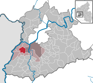
| Location of the local community Tawern in the district of Trier-Saarburg | ||
  |
||

Tawern (pronunciation with an emphasis on the second syllable) is a municipality in the district of Trier-Saarburg in Rhineland-Palatinate . She belongs to the Verbandsgemeinde Konz .
geography
The community lies on the edge of the Saar-Hunsrück Nature Park . On the slope of the Albach valley lies the district of Fellerich in a westerly direction . The district of Tawern also includes the residential areas Mertenmühle, Oberste Mausmühle and Unterste Mausmühle, and the district of Fellerich the Fellericher Mühle.
history
The place name Tawern comes from the Latin word taberna (shop, shop), which explains the emphasis on the second syllable of today's name Tawern . The first settlement was founded by the Romans around 2000 years ago, almost at the same time as the Roman settlement in Trier .
The place name refers to the origin of the place in Roman times and its original purpose. Probably at the same time as the Roman temple district on the Metzenberg, a "taberna", a rest area with a feeder and transformer station for draft animals, was probably built in the 1st century AD at the foot of the mountain, over which a trade route led to Metz. The Latin emphasis of the place name on the second syllable suggests continuous settlement since Roman times. Today Tawern has developed into a residential area and is located in the Obermosel-Saar recreation area and in the Saar-Hunsrück nature park .
There is a partially reconstructed temple complex in the forest on the Metzenberg above Tawern. In the local area there is a signposted excavation site of the former Roman street settlement.
On July 18, 1946, Tawern, together with 80 other municipalities in the districts of Trier and Saarburg , was annexed to the Saar area , which was separated from the rest of the French occupation zone in February 1946 and which at that time was no longer under the Allied Control Council. On June 6, 1947 this territorial outsourcing was withdrawn to 21 municipalities, so Tawern came to the 1946 newly formed state of Rhineland-Palatinate .
On March 17, 1974, the previously independent municipality of Fellerich was incorporated.
Municipal council
The local council in Tawern consists of 20 council members, who were elected in the local elections on May 26, 2019 in a personalized proportional representation, and the honorary local mayor as chairman. Until 2009, the council had 16 council members.
The distribution of seats in the local council:
| choice | SPD | CDU | total |
|---|---|---|---|
| 2019 | 9 | 11 | 20 seats |
| 2014 | 9 | 11 | 20 seats |
| 2009 | 8th | 12 | 20 seats |
| 2004 | 6th | 10 | 16 seats |
Personalities
- Erwin Schaaf (* 1933), historian and educator
See also

literature
- Ernst Wackenroder : The art monuments of the Saarburg district . (= Paul Clemen (Hrsg.): Die Kunstdenkmäler der Rheinprovinz , Volume 15, III. Department). L. Schwann, Düsseldorf 1939 (reprint published by the Academic Bookshop Interbook, Trier 1982), pp. 250-254.
Web links
- Tawern on an engraving from 1682 from Dilibri in high resolution
- tawern.info
- Link catalog on the subject of Tawern at curlie.org (formerly DMOZ )
Individual evidence
- ↑ State Statistical Office of Rhineland-Palatinate - population status 2019, districts, communities, association communities ( help on this ).
- ↑ State Statistical Office Rhineland-Palatinate (ed.): Official directory of the municipalities and parts of the municipality. Status: January 1, 2017 [ Version 2020 is available. ] . S. 76 (PDF; 1.9 MB).
- ↑ Official municipality directory (= State Statistical Office of Rhineland-Palatinate [Hrsg.]: Statistical volumes . Volume 407 ). Bad Ems February 2016, p. 179 (PDF; 2.8 MB).
- ^ The Regional Returning Officer Rhineland-Palatinate: Local elections 2019, city and municipal council elections

Aach | Ayl | Baldringen | Bekond | Notification | Beuren (high forest) | Bonerath | Damflos | Detzem | Ensch | Farschweiler | Fur | Fish | Pine | Franzenheim | Freudenburg | Geisfeld | Greimerath | Grimburg | Gusenburg | Gusterath | Gutweiler | Heddert | Stalling | Herl | Hermeskeil | Hinzenburg | Hinzert-Pölert | Hockweiler | Holzerath | Hedgehog | Irsch | Kanzem | Chasuble | Kastel-Staadt | Kell am See | Kenn | Kirf | Klüsserath | Conc | Cord | Korlingen | Köwerich | Lampades | Langsur | Leiwen | Lunge | Longuich | Lorscheid | Mandern | Mannebach | Mehring | Mertesdorf | Merzkirchen | Morscheid | Naurath (Eifel) | Naurath (forest) | Neuhütten | Newel | Nittel | Upper cheap | Ockfen | Ollmuth | Onsdorf | Osburg | Palzem | Paschel | Pellingen | Pluwig | Pölich | Ralingen | Swift oath | Reinsfeld | Riol | Riveris | Saarburg | Schillings | Schleich | Schoden | Schömerich | Schondorf | Schweich | Serrig | Sommerau | Taben-Rodt | Tawern | Temmels | Thomm | Thörnich | Trassem | Trierweiler | Trittenheim | Vierherrenborn | Waldrach | Waldweiler | Wasserliesch | Wawern | Waves | Welschbillig | Wiltingen | Wincheringen | Zemmer | Zerf | Züsch