
Farschweiler
| coat of arms | Germany map | |
|---|---|---|

|
Coordinates: 49 ° 43 ' N , 6 ° 50' E |
|
| Basic data | ||
| State : | Rhineland-Palatinate | |
| County : | Trier-Saarburg | |
| Association municipality : | Ruwer | |
| Height : | 433 m above sea level NHN | |
| Area : | 7.45 km 2 | |
| Residents: | 828 (Dec. 31, 2019) | |
| Population density : | 111 inhabitants per km 2 | |
| Postal code : | 54317 | |
| Area code : | 06500 | |
| License plate : | TR, SAB | |
| Community key : | 07 2 35 021 | |
| Association administration address: | Lower Kirchstrasse 1 54320 Waldrach |
|
| Website : | ||
| Mayoress : | Marion Jonas | |
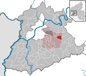
| Location of the local community Farschweiler in the district of Trier-Saarburg | ||
  |
||


Farschweiler ( Moselle Franconian : Foaschweila [ fɔɐʃvaɪ̯lɐ ]) is a municipality in the district of Trier-Saarburg in Rhineland-Palatinate . It belongs to the Verbandsgemeinde Ruwer , which has its administrative headquarters in Waldrach .
geography
Farschweiler lies between the cities of Trier and Hermeskeil in the meadow of a flat branch of the Feller Bach on the north-western edge of the Osburger Hochwald , part of the Hunsrück low mountain range and on the edge of the Saar-Hunsrück nature park .
Farschweiler also includes the Backeshof, Birkenhof, Farschweiler Forsthaus and Klostermühle (Gehrensmühle) residential areas .
Surrounding communities are Herl , Lorscheid , Beuren , Osburg and Thomm .
history
The place was probably built in the Merovingian expansion period (600 - 750). Between 1190 and 1200 it appears for the first time as Varneswilre in Trier city law . The current Romanesque church dates from 1788. It was expanded in 1844 with a two-axis extension and a new choir and tower.
Until the end of the 18th century, the place belonged to the Electoral Trier Office Pfalzel . In 1816, the French Mairie Farschweiler became the Prussian mayor's office in Farschweiler , which was renamed the Farschweiler Office in 1927 . With the places Farschweiler, Herl, Lorscheid, Osburg and Thomm it came in 1934 to the office Waldrach in Ruwer .
Population development
The development of the population of Farschweiler, the values from 1871 to 1987 are based on censuses:
|
|
Graphic of the population development

|
politics
Local mayor
- 1984-2009: Werner Schmitt
- 2009–2016: Silke Bigge
- since 2016: Marion Jonas
coat of arms
|
|
Blazon : “In gold a curled black tip, growing in it a golden church with black windows, the roof and spire are shown in the left and upper part of the tip; in front a continuous red cross, behind a black fir tree. " |
| The reason for the coat of arms: The well-known pilgrimage church " Mariä Heimsuchung " is, in addition to the Electoral Trier cross, an expression of the special bond between the local community of Farschweiler and the church and state. The fir tree symbolizes the community's abundance of forests . |
Culture and sights
Several clubs are active in various cultural and sporting areas.
- Attractions
- Catholic Church of the Visitation of the Virgin Mary
- Way of the Cross and Marienkapelle
- Barrows
- Menhir of Farschweiler (Hinkelstein)
- Roman fountain
- Roman sarcophagus near the cemetery
- Monastery mill
- The 3.4 kilometer forest thistle trail leads through part of the community forest of Farschweiler.
- Roman Celtic Path , Dream Loop on the Saar-Hunsrück Climb (13.1 km)
Economy and Infrastructure
The town's largest employer is the Annen joinery, founded in 1956 . Other small and medium-sized companies are based in Farschweiler as well as a self-service center run by Sparkasse Trier .
Local media are the Trierische Volksfreund , the Wochenspiegel and the official gazette of the VG Ruwer.
A public institution is the Farschweiler volunteer fire brigade with a fire station , which provides defensive fire protection and general help. Farschweiler has a community center , a primary school and a sports complex . There is a kindergarten in Lorscheid.
Farschweiler is located on the district road 84 , which leads in the direction of Herl to the state road 149 and in the direction of Osburg-Sternfeld to the state road 151 (formerly federal road 52 ).
Personalities
- Ernst Annen, holder of the Federal Cross of Merit on ribbon and the badge of honor of the state of Rhineland-Palatinate
- Alfred Wahlen (* 1958), football player
- Helmut Wahlen (* 1964), soccer player
- Andreas Becker (* 1965), bodybuilder
Web links
- Website of the community of Farschweiler
- Link catalog on Farschweiler at curlie.org (formerly DMOZ )
- To search for cultural assets of the local community Farschweiler in the database of cultural assets in the Trier region .
Individual evidence
- ↑ a b State Statistical Office of Rhineland-Palatinate - population status 2019, districts, municipalities, association communities ( help on this ).
- ↑ State Statistical Office Rhineland-Palatinate (ed.): Official directory of the municipalities and parts of the municipality. Status: January 2018 [ Version 2020 is available. ] . S. 76 (PDF; 2.2 MB).
- ↑ State Statistical Office Rhineland-Palatinate - regional data
- ↑ books.google.de
- ↑ openstreetmap.org

Aach | Ayl | Baldringen | Bekond | Notification | Beuren (high forest) | Bonerath | Damflos | Detzem | Ensch | Farschweiler | Fur | Fish | Pine | Franzenheim | Freudenburg | Geisfeld | Greimerath | Grimburg | Gusenburg | Gusterath | Gutweiler | Heddert | Stalling | Herl | Hermeskeil | Hinzenburg | Hinzert-Pölert | Hockweiler | Holzerath | Hedgehog | Irsch | Kanzem | Chasuble | Kastel-Staadt | Kell am See | Kenn | Kirf | Klüsserath | Conc | Cord | Korlingen | Köwerich | Lampades | Langsur | Leiwen | Lunge | Longuich | Lorscheid | Mandern | Mannebach | Mehring | Mertesdorf | Merzkirchen | Morscheid | Naurath (Eifel) | Naurath (forest) | Neuhütten | Newel | Nittel | Upper cheap | Ockfen | Ollmuth | Onsdorf | Osburg | Palzem | Paschel | Pellingen | Pluwig | Pölich | Ralingen | Swift oath | Reinsfeld | Riol | Riveris | Saarburg | Schillings | Schleich | Schoden | Schömerich | Schondorf | Schweich | Serrig | Sommerau | Taben-Rodt | Tawern | Temmels | Thomm | Thörnich | Trassem | Trierweiler | Trittenheim | Vierherrenborn | Waldrach | Waldweiler | Wasserliesch | Wawern | Waves | Welschbillig | Wiltingen | Wincheringen | Zemmer | Zerf | Züsch