Rehorn Mountains
| Rehorn Mountains ( Rýchory ) | ||
|---|---|---|
|
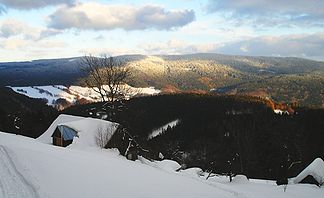
The Rehorn Mountains in winter |
||
| Highest peak | Dvorský les ( Hofelbusch ) ( 1033 m nm ) | |
| location | Czech Republic | |
| part of | Sudeten | |
|
|
||
| Coordinates | 50 ° 39 ′ N , 15 ° 52 ′ E | |
The Rehorn Mountains (Czech Rýchory ) are the southeastern foothills of the Giant Mountains . It is located in the north of the Czech Republic on the border with Poland and belongs to the Krkonošský Národní Park (KRNAP) (Giant Mountains National Park). The highest point is the Dvorský les ( Hofelbusch , also Höfelbusch ) at 1033 m .
location
To the south, the Rehorn Mountains merge into the Giant Mountains foothills, to the east it is separated from the Raben Mountains by the Ličná and Dlouhá Voda ( Langengrundwasser ) valleys. Through this valley at Královec an earlier important connection ran over the Královecký průsmyk ( Königshaner Pass ) and Královecké sedlo (Polish Przełęcz Lubawska , German Liebauer Pass ) from Bohemia to Silesia . The Liebauer Tor connects to the northeast and in the northwest the Rehorn Mountains at the Kolbenkamm and Schmiedeberger Kamm merge into the Giant Mountains and the Landeshuter Kamm . To the west the valley of the Malá Úpa ( Little Aupa ) and after its confluence the valley of the Úpa ( Aupa ) form the natural border with the Giant Mountains.
The economic and cultural center of the mountains is the old mountain town of Žacléř (Schatzlar) . The Rehorn Mountains are sparsely populated and consist of primeval forest on its main ridge. There are numerous hiking trails leading to the Rýchorská bouda ( Rehornbaude ) in a star shape , but unlike the Giant Mountains, it does not have a large number of mining sites . The only object of this type is the Rýchorská bouda, located at 1001 m high Kutná, which houses the Giant Mountains Center for ecological education and a snack. In the southeast of the mountains there is the Stachelberg Fortress, a large fortification of the Czechoslovak Wall . On the northern slope of the Žacléřský hřbet ( Schatzlarer Ridge ) rises in the nature reserve Boberská stráň ( Boberlehne ) above Bobr the Bober . The opposite side drains into the Úpa - the ridge is thus a watershed (North / Baltic Sea).
geology
The slope of the Lower Silesian-Bohemian coal basin of Wałbrzych ( Waldenburg ) , which extends into the mountains, is geologically significant . The oldest coal mines in the Czech Republic are located near Žacléř. They have been in operation since the 16th century and expanded in the 18th to 20th centuries. The mining took place down to a depth of 132 m . The pit has been closed since 2012, largely backfilled, and above-ground facilities have been preserved as a museum. Paleontological finds can also be viewed there.

