
Raba (Gurk)
| Raba | ||
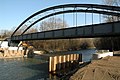
 Raba trickle on the first kilometer near Judendorf |
||
| Data | ||
| location | District of Klagenfurt-Land , Carinthia , Austria | |
| River system | Danube | |
| Drain over | Gurk → Drau → Danube → Black Sea | |
| origin | Municipality Maria Saal , the confluence of two rills between Winklern cell and 46 ° 40 '30 " N , 14 ° 21' 30" O |
|
| Source height | 485 m above sea level A. | |
| muzzle | near Niederdorf (Gem. Ebenthal ) in the Gurk coordinates: 46 ° 37 ′ 10 ″ N , 14 ° 24 ′ 48 ″ E 46 ° 37 ′ 10 ″ N , 14 ° 24 ′ 48 ″ E |
|
| Mouth height | 412 m above sea level A. | |
| Height difference | 73 m | |
| Bottom slope | 8.1 ‰ | |
| length | 9 km | |
| Catchment area | 22.7 km² | |
The Raba (Slovenian Rába ) is an approximately 9 kilometer long stream in Lower Carinthia .
course
It rises in a by Dränungs converted -measures to farmland lowland fen in the market town of Maria Hall near the village of Winklern and flows initially as a trickle south through the gentle valley between Maria Saal Berg and the sixties mountain , then clips the village of God Bichl , draws then past the ponds east of the runway at Klagenfurt Airport , the direction of flow gradually changes towards the southeast and drains the plain east of Klagenfurt by running through fields, floodplains, corridors, meadows and small forest areas.
The stream then runs between the villages of Gutendorf and Hörtendorf . In the northeast of Limmersdorf the Raba runs through fertile farmland. The small river soon reaches the Niederdorf district of Ebenthal and flows into the Gurk to the south near the railway bridge .
History
The meadow master builder Josef Eckert was entrusted with the planning and implementation of the Raba regulation as well as the reclamation of wet meadows, moors, mosses and swamps in the catchment area of this small river. These measures, important for better agricultural land use, were implemented from the end of the 19th century. Today the Zell-Winklern drainage cooperative represents the interests of those farmers in the headwaters whose land is drained into the Raba.
gallery

Raba origin, behind it Winklern and Sechzigerberg

Josef Eckert memorial stone west of Gottesbichl

Raba brook west of Niederdorf
Raba estuary under the Gurk railway bridge near Niederdorf


Web links
Individual evidence
- ↑ a b KAGIS - Carinthia Atlas
- ↑ Federal Ministry of Agriculture, Forestry, Environment and Water Management (Ed.): Area directory of the Austrian river basins: Draugebiet. Contributions to the hydrography of Austria, issue No. 59, Vienna 2011, p. 79 ( PDF; 3.5 MB )