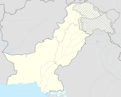
Rahimyar Khan
|
Rahimyar Khan رحیم یار خان |
||
| State : |
|
|
| Province : | Punjab | |
| Coordinates : |
28 ° 25 ' N , 70 ° 18' E
|
|
| Residents : | 420,419 (2017) | |
| Time zone : |
PST ( UTC + 5 )
|
|
|
|
||
Rahimyar Khan or Rahim Yar Khan ( Urdu : رحیم یار خان) is a city in the south of the Pakistani province of Punjab . The old name of the city, which was laid out as a fortress by Fazal Elahi Halani in 1750 , was Naushehra.
1883 changed Nawab Sadiq Khan IV. Of Bahawalpur the name of the city and named it after his son Rahim Yar Khan. Today the city lies on an important railway line that leads to Sukkur in the south and Bahawalpur in the north . In 1998 the city had a population of 233,537 and had an annual population growth of 4.04 percent. At the 2017 census, the population had increased to 420,419. The Rahimyar Khan Airport is served from Lahore, among others.
The closest river is the Indus , which flows about 40 kilometers northwest of the city. The city's population is 96.7 percent Muslim , followed by 1.8 percent Hindus . Other religions such as Christians or Sikhs are hardly represented.
District
The district of the same name borders on Muzaffargarh in the north, Bahawalpur in the east, Jaisalmer ( India ) in the south and Ghotki in the west . Its total area is approximately 11,880 km².
Rahimyar Khan's climate is very hot and dry in summer and cold and dry in winter. The summer season is comparatively longer than the winter season. It starts in April and lasts until the end of October. Winter lasts from November to March. There are frequent storms and thunderstorms in summer. The average rainfall is about 100 mm.
Town twinning
See also
Web links
- Official Website Rahimyar Khan Dot Com (Engl.)
