Rautejöchli
| Rautejöchli | |||
|---|---|---|---|
| Compass direction | south | North | |
| Pass height | 2757 m above sea level A. | ||
| Talung | Paznaun | Stanzertal | |
| Watershed | Moosbach → Rosanna → Sanna (→ Inn) | Madleinbach → Trisanna → Sanna | |
| Valley locations | Ischgl | St. Anton am Arlberg | |
| Mountains | Verwallgruppe , Kuchenspitzgruppe : Küchlspitze / Rautekopf | ||
| profile | |||
| Ø pitch | % (1381 m /? Km) | % (1473 m /? Km) | |
| Map (Tyrol) | |||
|
|
|||
| Coordinates | 47 ° 2 '29 " N , 10 ° 14' 38" E | ||
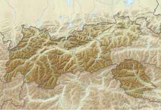
The Rautejöchli is a 2757 m above sea level. A. high pass in Verwall in Tyrol . It lies between St. Anton am Arlberg in the Stanzer Tal and Ischgl in the Paznaun .
Location and landscape
The yoke lies between Küchlspitze ( 3147 m above sea level ) to the west and Rautekopf ( 2849 m above sea level ) to the east, and thus crosses the main ridge of the Verwall.
The rear Madleinalpe extends south over Ischgl ( 1376 m above sea level ) . Here in the Hochkar there are two small cirque lakes at 2483 m above sea level. A. The Madleinalpe then drains over the Madleinbach to Trisanna . To the north extends the Große Küchlferner , one of the group's small glaciers, and the Hintere Kartell , the western high valley of the Moosbach . Here it leads over the cartel store to 2020 m above sea level. A. to St. Anton (bridge of the Rosanna 1300 m above sea level , the place 1284 m above sea level ).
To the east of the yoke is a small Hochkar with another cirque lake.
Development and ways
You cross the Rautejöchli when you cross from the Friedrichshafner Hütte ( 2138 m above sea level ) near Galtür to the Darmstädter Hütte , which is at 2384 m above sea level. A. is above the Kartellsee. The path, called Ludwig-Dürr-Weg , leads over Muttenalpe - upper Fallbach over a 2666 m above sea level. A. high Joch and then as a high path east below Matnalkopf and Schönpleisköpf over to Rautejöchli, and over the glacier down. The glacier crossing is unmarked and high alpine.
The pass is less frequented from Ischgl, here you choose the Doppelseescharte ( 2786 m above sea level ) to the east.
