Schönpleisjöchli
| Schönpleisjöchli | |||
|---|---|---|---|
| Compass direction | west | east | |
| Pass height | 2809 m above sea level A. | ||
| Talung | Paznaun | Verwalltal | |
| Watershed | (nameless channel) → Fasulbach → Rosanna → Sanna (→ Inn) | Madleinbach → Trisanna → Sanna | |
| Valley locations | Ischgl | Konstanzer Hütte near St. Anton am Arlberg | |
| Mountains | Verwallgruppe : Karkopfgruppe / Kuchenspitzgruppe | ||
| profile | |||
| Ø pitch | % (1433 m /? Km) | % (1121 m /? Km) | |
| Map (Tyrol) | |||
|
|
|||
| Coordinates | 47 ° 1 '52 " N , 10 ° 13' 52" E | ||
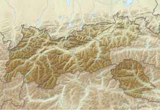
The Schönpleisjöchli is 2809 m above sea level. A. high pass in Verwall in Tyrol . It is located between the Verwall valley near St. Anton am Arlberg and Ischgl in Paznaun . The two peaks on either side of the yoke are the Schönpleisköpfe .
Location and landscape
The yoke lies between Küchlspitze ( 3147 m above sea level ) to the north and Karkopf ( 2948 m above sea level ) south and thus crosses the main ridge of the Verwall. On both sides of the yoke are two peaks called Nördlicher Schönpleiskopf ( 2948 m above sea level ) and Südlicher Schönpleiskopf ( 2920 m above sea level ).
The rear Madleinalpe extends east over Ischgl ( 1376 m above sea level ) . Here in the Hochkar there are two small cirque lakes at 2483 m above sea level. A. The Madleinalpe then drains over the Madleinbach to Trisanna . West is the Kar, located in the the rest of the glacial Karkopfes, and down into the Fasultal performs a tributary valley of Verwalltales . There is the Konstanzer Hütte ( 1688 m above sea level ), which belongs to the municipality of St. Anton.
The word Bleis, Pleiß is an Old High German word for steep slope and is common in the area.
At Schönpleisjöchli, the Verwall group is divided into the Karkopf group around Karkopf and Matnalkopf to the southwest, and the Kuchenspitz group around the Kuchenspitze and Küchlspitze to the northwest.
Development and ways
The Schönpleisjöchli is seldom used. It represents a transition from Ischgl to the Verwall valley, but today you usually go over the Doppelseescharte and Darmstädter Hütte . The path is only marked for experienced alpinists (isolated Steinmandl).
The two Schönpleis heads are hardly used either. However, they are named as demanding ski touring mountains.
Directly east below the Schönpleisjöchli, however, the path from the Friedrichshafner Hütte crosses the Rautejöchli to the Darmstädter Hütte , the Ludwig-Dürr-Weg .
Individual evidence
- ↑ The yoke lies on the municipal boundary, St. Anton is indicated as the municipality.
- ↑ cf. Südlicher Schönpleiskopf 2920 m , photo on hikr.org, from the Küchlspitze southwards.
- ^ Heinz Dieter Pohl: The most frequent mountain appellatives in Austria , entry Bleis (Pleis) p. 3 (pdf, uni-klu.ac.at. Accessed December 28, 2014).
- ↑ This is the name of some avalanche lines in Paznaun Pleißen .
- ↑ Peter Pindur, Roland Luzian, Andreas Weiskopf: Alpenvereinsführer Verwallgruppe , Bergverlag Rother, 10th edition, 2005, ISBN 3-7633-1251-X .
- ↑ Alpine Club Guide Verwallgruppe , there 1820 Nördlicher Schönpleiskopf p. 221 and 1560 Südlicher Schönpleiskopf . The authors note briefly: "insignificant peak".
- ↑ Nördlicher Schönpleiskopf 2943m - dream run in the Verwall group , Südlicher Schönpleiskopf 2920m - the somewhat easier to reach summit of the two Schönpleisköpf , tour report on skitours-paradise.com
