
Regge (river)
| Regge | ||
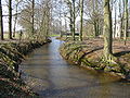
 The “Steep Ufer” with a dead arm of the Regge near Nieuwebrug, south of Ommen |
||
| Data | ||
| location | Overijssel , Netherlands | |
| River system | Rhine | |
| Drain over | Vechte → Zwarte Water → IJsselmeer → North Sea | |
| River basin district | Zwarte Water | |
| source | near Goor , Gem. Hof van Twente 52 ° 16 ′ 46 ″ N , 6 ° 36 ′ 37 ″ E |
|
| Source height | 12 m NAP | |
| muzzle | near Ommen in the Vechte Coordinates: 52 ° 30 ′ 49 " N , 6 ° 22 ′ 55" E 52 ° 30 ′ 49 " N , 6 ° 22 ′ 55" E |
|
| Mouth height | 5 m NAP | |
| Height difference | 7 m | |
| Bottom slope | 0.15 ‰ | |
| length | 46.5 km | |
| Catchment area | 880 km² | |
| Discharge at the Archem A Eo gauge : 740 km² |
MQ 1974–1985 Mq 1974–1985 |
8.125 m³ / s 11 l / (s km²) |
The Regge is just over 8 m / s of water-rich tributary of the Vecht and runs in the Dutch province of Overijssel .
The source of the Regge is located near the town of Goor in the municipality of Hof van Twente . From there it flows north through Rijssen , Nijverdal and Hellendoorn and flows into the Vechte near Ommen .
The river, which is up to 30 meters wide, was canalized from 1900 and is currently being renatured in sections.
When the Twente Canal was built until 1938, the upper reaches of the Regge were cut off and now drains via the Twente Canal. Currently, under the name De Doorbraak ("the breakthrough"), a 13-kilometer-long watercourse is being built that will restore the old waterway connection (probably by 2014).
The European long-distance hiking trail E11 from The Hague to the Polish border runs partly along the Regge.
Boven-Regge north of the Twente Canal

The Regge in the southeast of Enter

The regge

Regge at Goor


Boven-Regge near Diepenheim

In dry times, the water level from the Schipbeek can be increased.
Westervlier

Fish ladder on the Regge

The Regge near Warmelo ( Diepenheim )


Individual evidence
- ↑ a b Google Earth
- ↑ Bertus de Graaff, Paul Termes: Morphological ontwerp Regge met historical Gegevens , 2008
- ↑ GRDC level data from EWA stations (European Water Archive)
- ↑ Doorbraak website , accessed January 7, 2016
- ↑ Wasserverband Regge en Dinkel : Joint approach for managing flooding ( page can no longer be accessed , search in web archives ) Info: The link was automatically marked as defective. Please check the link according to the instructions and then remove this notice. (As of June 4, 2012)