Ringkøbing Fjord
| Ringkøbing Fjord | ||
|---|---|---|

|
||
| Geographical location | Midtjylland , Denmark | |
| Drain | at Hvide Sande to the North Sea | |
| Places on the shore | Bork Havn , Hvide Sande , Nymindegab , Ringkøbing , Søndervig | |
| Data | ||
| Coordinates | 56 ° 0 ′ N , 8 ° 14 ′ E | |
|
|
||
| surface | 300 km² | |
| length | 30 km | |
| width | 12 km | |
| Maximum depth | 6 m | |
| Middle deep | 1.5 m | |
|
particularities |
Largest coastal lake in Denmark |
|
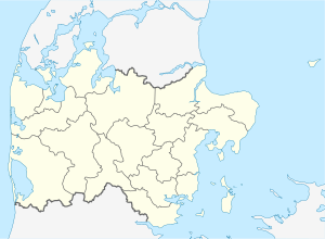
The Ringkøbing Fjord is the largest coastal lake in Denmark with an area of 300 km² . The brackish lake is about 30 km long, 12 km wide and an average of only 1.5 m deep. It is separated from the open North Sea by the 30 km long and at its narrowest point only a few hundred meters wide spit called Holmsland Klit . At the village of Hvide Sande ("White Sand") there is a connection so that smaller ships can enter and exit and water exchange is guaranteed.
The Ringkøbing Fjord is surrounded by the towns of Søndervig in the north-west, the eponymous Ringkøbing in the north-east, Nymindegab in the south and the lock town of Hvide Sande in the west.
The Tipperne peninsula in the south of the Ringkøbingfjord is a bird sanctuary .
In the 17th century the opening to the open sea was about in the middle of the Holmsland Klit, almost exactly opposite the mouth of the Skjern Å river into the fjord. Due to the ocean current running essentially from north to south, this outlet was moved to the south by lengthening the northern arm and pushing itself in front of the southern arm. In this way, towards the end of the 19th century, the process had shifted to the southern end of the fjord and was almost silted up. The Tipperne peninsula is the remainder of the former southern spit. At the place Nymindegab you can still see the remains of the old watercourse.
To keep shipping going and to prevent the lake from sweetening up, Holmsland Klit was pierced between 1909 and 1910 near what is now Hvide Sande. The Hvide-Sande Canal was 26 meters wide and 2.5 meters deep, but was torn open a year later by a storm surge and expanded to a width of 230 meters in the following years. It was difficult to close the opening again in 1915.
Due to disputes between the residents of the northern and southern parts of the Holmsland Klit and technical issues, a new attempt to re-establish the connection between the coastal lake and the sea was not made until 1923. The canal was finally opened in its current form in 1931. Since then, a lock has been regulating the water level in Ringkøbing Fjord.
Ecological renovation
Since the 1970s, the fish population and the numbers of migratory and breeding birds have declined. Nitrogen discharges from agriculture led to an increased occurrence of cyanobacteria (blue-green algae). The ecological balance of the water was threatened.
The Danish nature authority Naturstyrelsen therefore commissioned investigations in 1993. Based on this, more salt water has been smuggled in since 1995 in order to restore a more robust ecosystem. In fact, the exposure to blue-green algae has since decreased and the sand gape clam has been able to spread. It is used as food for many fish species, e.g. B. the flounder .
As a further measure to rehabilitate the Ringkøbing Fjord, the renaturation of the Skjern Å river was started . Denmark's most water-rich river drains an area of 2100 km² into the Küstensee (the second largest river basin in the country). If it regains its self-cleaning power, Ringkøbing Fjord will also benefit from it. In 2012, however, the parliament abandoned the ambitious plan to establish a national park in Skjern Å.
Web links
- Ringkøbing Fjord Reserve Danish Nature Conservation Agency
- Landscape photos from Ringkøbing Fjord
