
Ringkøbing
| Ringkøbing | |||||
|
|||||
| Basic data | |||||
|---|---|---|---|---|---|
| State : |
|
||||
| Region : | Midtjylland | ||||
|
Municipality (since 2007) : |
Ringkøbing-Skjern | ||||
| Coordinates : | 56 ° 5 ' N , 8 ° 15' E | ||||
|
Population : (2020) |
9,923 | ||||
| Postal code : | 6950 | ||||
| Website: | www.rksk.dk | ||||
 Church in Ringkøbing |
|||||


Ringkøbing is a small town in Denmark and the administrative seat of the municipality of Ringkøbing-Skjern . Ringkøbing is located on Ringkøbing Fjord near the North Sea . The city has 9923 inhabitants (as of January 1, 2020) and an area of 400.9 km². From 1794 to 1970 Ringkøbing was the county seat of Ringkøbing Amt , from 1970 to 2007 of Ringkjøbing Amt ; from 1970 to 2007 Ringkøbing was the center of the municipality of Ringkøbing .
The old town of Ringkøbing has old streets that were laid out at right angles around the Torvet market square . The naming of the main axes is unique in Denmark: Vestergade, Østergade, Nørregade and Søndergade are - unlike usual - not named after their direction from the town center to the city limits, but after their geographical position in the city.
Worth the City Museum are Ringkøbing-Skjern Museum and the church of the 14th century (1934-35 newly blinded ), the tower tapers downwards. The altarpiece was created by Arne Haugen Sørensen, parts of the organ date from the 17th century.
history
Archaeological finds suggest that it was formed in the 13th century. At that time Ringkøbing had the only port on the Danish North Sea coast due to its sheltered location on the lagoon ; the Limfjord further north was still separated from the sea. Since the 17th century, however, the entrance to the Ringkøbing Fjord increasingly silted up, and wind and ocean currents shifted it southwards. The city lost its importance as a port. Only with the creation of the channel of Hvide Sande link is restored to the open sea.
During the Second World War , the city was surrounded with anti-tank barriers . In addition, concrete piles with iron spikes were dug in the fields around the village to prevent enemy planes from landing; bunkers were erected throughout the city. Another focus of the Atlantic Wall was the Søndervig Army Coast Battery . A total of 19 Allied aircraft were shot down by the " grass snake " facility in Houvig around the fjord .
sons and daughters of the town
- Anders Holch Povlsen (* 1972), entrepreneur
- Claus Møller Jakobsen (* 1976), handball player
- Kristian Kolby (* 1978), racing driver
- Hans Henrik Andreasen (* 1979), football player
- Jonas Borring (* 1985), soccer player
- Lasse Heinze (* 1986), soccer player
- Mia Biltoft (* 1992), handball player
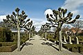
gallery

Street in the old town

railway station

City map around 1900

At the port
graveyard


literature
- Bent Bågøe Anthonisen: Atlantvolden ved Ringkøbing / The Atlantic Wall at Ringkøbing . Ringkøbing 1983, ISBN 87-89155-27-0 .
Web links
Individual evidence
- ↑ a b Statistics Banks -> Befolkning og valg -> BY1: Folketal January 1st efter byområde, alder og køn (Danish)
- ↑ Peter Tudvad: Kierkegaard Jyllandsrejse , Copenhagen of 2006.
- ↑ Ringkøbing Kirke Nationalmuseet, Danmarks kirker, accessed on August 1, 2015.
- ↑ Bent Bågøe Anthonisen: The Atlantic Wall in Ringkøbing . Ringkøbing 1983, ISBN 87-981206-4-6 , p. 74-79 .
Ådum | Astrup | Bard | Bølling | Borris | Fjelstervang | Grønbjerg | Hee | Hemmet | Herborg | Højmark | Hoven | Hvide Sande | Monastery | Lem | Lønborg | Lyne | No | Nørre Bork | Ølstrup | Rækker Mølle | Ringkøbing | Skjern | Sønder Vium | Spjald | Stauning | Tarm | Tim | Troldhede | Velling | Videbæk | Vorgod | Vorgod Bard